
More details
Collapse details
Date Published:
Filesize:
- April 1, 2024
This report describes results from vessel surveys and visual species-verification trials conducted at the Jacksonville Shallow Water Training Range (JSWTR) in the Jacksonville Operating Area (OPAREA). This work continues from a multi-institutional monitoring program intended to provide information on the species composition, population identity, density, and baseline behavior of marine mammals and sea turtles present in United States (U.S.) Navy range complexes along the U.S. Atlantic Coast.
- 17,443.07 KB
More details
Collapse details
Date Published:
Filesize:
- July 4, 2015
This report documents the findings of a pilot study conducted in 2013 to investigate the efficacy of ground-based surveys as a potential alternative to, or in supplementation of, aerial surveys in detecting strandings of marine mammals and sea turtles (MM/ST) on remote shorelines, in this case the island of Ni‘ihau. In this study, aerial (helicopter) and ground-based (vehicle and horseback) shoreline surveys were conducted concurrently in order to compare the efficacy of each method. Observers scanned the shorelines of Kauai and Ni‘ihau, adjacent to PMRF, for stranded and near-stranded marine mammals and sea turtles within one week after an SCC training event that involved mid-frequency active sonar in August 2013.
- 11,018.81 KB
More details
Collapse details
Date Published:
Filesize:
- July 11, 2011
Ecological acoustic recorders (EARs) have been deployed around the islands of Oahu and Kauai in a project sponsored by the Office of Naval Research. Detailed information on the EAR was published by Lammers et al. (2008). EARs have been deployed from February, 2009 to the present time around Oahu and from February, 2009 until April, 2011 around Kauai. From April, 2011 four EARs in the waters of Kauai have been deployed along the southern coast.
- 1,372.43 KB
Behavior and group characteristics differ in mixed-species associations (MSA) of cetaceans in the Southern California Bight.
Southern California Marine Mammal Workshop 2014 .
More details
Collapse details
Date Published:
Filesize:
- January 31, 2014
Effects of mixed-species associations (MSA [at least two different species swimming together and / or inte racting]) on cetacean behavior rarely have been quantified, but are important for identifying and differentiating potential anthropogenic impacts . Baseline marine mammal behavior was assessed during 83 ,005 km of U.S. Navy supported aerial line-transect surveys in the Southern California Bight during 2008-2013.
- 1,649.75 KB
Mixed-species associations of marine mammals in the Southern California Bight, with emphasis on Risso’s dolphins (Grampus griseus).
Aquatic Mammals. 2017.
43:177-184
More details
Collapse details
Date Published:
Publication:Ocean:Region:Species:Methods:
- January 1, 2017
This study investigates mixed-species associations among marine mammals in the Southern California Bight, focusing specifically on Risso's dolphins (Grampus griseus). Over a six-year period, aerial surveys were conducted to record the frequency and nature of these associations, revealing that Risso's dolphins were the most commonly observed species in mixed interactions. The results indicate a significant decline in the proportion of Risso's dolphins involved in such associations compared to historical records, possibly due to an increase in their relative abundance. The findings underline the importance of monitoring mixed-species associations to understand marine mammal dynamics and ecological interactions.
More details
Collapse details
Date Published:
Filesize:
- November 1, 2018
In August 2017, a marine mammal monitoring project was carried out combining boat-based field efforts and passive acoustic monitoring on and around the Pacific Missile Range Facility (PMRF). Commander, Pacific Fleet (PACFLT) funded five days of small-boat effort and the National Marine Fisheries Service funded an additional six days of effort. Information obtained was compared to previous sightings during small-boat effort by Cascadia Research Collective (CRC) off Kauai and Niihau, during 1,119 hr of effort (19,194 km) over nine different years from 2003 through 2016 (see Baird 2016)
- 2,093.16 KB
More details
Collapse details
Date Published:
Filesize:
- February 13, 2020
As part of the long-term United States (U.S.) Navy-funded Marine Species Monitoring Program, from 16–24 August 2022, Cascadia Research Collective (CRC) carried out a vessel-based field effort in conjunction with passive acoustic monitoring undertaken by U.S. Navy (Navy) scientists on and around the underwater hydrophone ranges of the Pacific Missile Range Facility (PMRF).
- 2,743.90 KB
More details
Collapse details
Date Published:
Filesize:
- November 30, 2023
As part of the long-term United States (U.S.) Navy-funded Marine Species Monitoring Program, from 5-13 August 2023, Cascadia Research Collective (CRC) carried out a vessel-based field effort in conjunction with passive acoustic monitoring undertaken by U.S. Navy (Navy) scientists on and around the underwater hydrophone ranges of the Pacific Missile Range Facility (PMRF).
- 2,846.35 KB
More details
Collapse details
Date Published:
Filesize:
- February 13, 2022
As part of the long-term United States (U.S.) Navy-funded Marine Species Monitoring Program, from 1-14 August 2021, a combination of boat-based field effort and passive acoustic monitoring was carried out on and around the underwater hydrophone ranges of the Pacific Missile Range Facility (PMRF).
- 4,288.46 KB
More details
Collapse details
Date Published:
Filesize:
- July 17, 2015
The purpose of this report is to summarize information obtained through the remote deployment of Low-Impact Minimally-Percutaneous External-electronics Transmitter (LIMPET) satellite tags on odontocete cetaceans off Cape Hatteras, North Carolina, in 2014. This study was undertaken to provide information on spatial use and diving behavior of a number of species of odontocetes, with particular emphasis on Cuvier’s beaked whales (Ziphius cavirostris) and short-finned pilot whales (Globicephala macrorhynchus).
- 2,545.14 KB
More details
Collapse details
Date Published:
Filesize:
- July 28, 2016
The present work is intended to complement ongoing research by Duke University off Cape Hatteras (hereinafter referred to as the Duke program) by providing information on the movement and diving behavior of these species over the medium term (weeks to months). The Duke program is focusing on shorter-term dive behavior (i.e., hours to days) using Digital Acoustic Tags and longer-term movements (i.e., months to years) using photo-identification (photo-ID) techniques
- 5,058.82 KB
More details
Collapse details
Date Published:
Filesize:
- August 1, 2017
. This report summarizes information obtained through additional field efforts undertaken in 2016, while incorporating results from the first two years of effort. The present work is intended to complement ongoing research by Duke University off Cape Hatteras (hereinafter referred to as the Duke program) by providing information on the movement and diving behavior of these species over the medium term (weeks to months)
- 11,433.38 KB
More details
Collapse details
Date Published:
Filesize:
- March 1, 2018
This work builds upon and complements longer-term studies of movements and site fidelity of both Cuvier’s beaked whales (Ziphius cavirostris) and short-finned pilot whales (Globicephala macrorhynchus) off the North Carolina coast using photo-identification (photo-ID)
- 4,344.84 KB
More details
Collapse details
Date Published:
Filesize:
- June 1, 2019
This work builds upon and complements longer-term studies of movements and site fidelity of both Cuvier’s beaked whales (Ziphius cavirostris) and short-finned pilot whales (Globicephala macrorhynchus) off the North Carolina coast using photo-identification (photo-ID)
- 2,642.94 KB
More details
Collapse details
Date Published:
Filesize:
- May 30, 2014
The Pacific Missile Range Facility (PMRF) off the island of Kaua‘i is the site of regular United States (U.S.) Navy training, some of which involves mid-frequency active sonar (MFAS) use from different types of military sound sources. PMRF includes acoustic instrumentation which allows for passive acoustic monitoring (PAM) capabilities to detect and localize sounds such as vocalizing marine mammals. Recent boat-based studies at PMRF have utilized real-time PAM (in conjunction with the Marine Mammal Monitoring on Navy Ranges project) to detect odontocetes for vectoring a field tagging boat to groups in order to increase the likelihood of deploying satellite tags. The resulting data have allowed for an assessment of habitat use and range of several different species. Some of these boat-based tagging efforts were timed to occur just before Submarine Commanders Courses (SCCs) occurring on PMRF so that animal movements and diving behavior could be measured both before and during sonar use.
- 1,819.34 KB
More details
Collapse details
Date Published:
Filesize:
- May 1, 2024
As part of the long-term United States (U.S.) Navy-funded Marine Species Monitoring Program, from 11–19 February 2024, Cascadia Research Collective (CRC) carried out a vessel-based field effort in conjunction with passive acoustic monitoring undertaken by the U.S. Navy (Navy) scientists on and around the underwater hydrophone ranges of the Pacific Missile Range Facility (PMRF). The effort was timed to occur immediately prior to the start of a Submarine Command Course (SCC) to allow for collection of movement and dive data that could be used to examine exposure and response of cetaceans to Navy mid-frequency active sonar (MFAS; see Henderson et al. 2021). Eight days of field effort were funded by the Navy, and one day of field work was funded by National Oceanic and Atmospheric Administration (NOAA) Fisheries. Wildlife Computers SPLASH10-F satellite tags were funded by the Navy for deployment on Navypriority species, and additional tags were provided by Wildlife Computers or CRC for deployment on other species (e.g., humpback whales [Megaptera novaeangliae]). Tags were programmed to collect dive behavior and Fastloc®-Global Positioning System (GPS) data from the time deployed until three and a half days after the end of the SCC and continue to transmit the dive and Fastloc®-GPS data for an additional six days. Starting on either May 2nd or May 3rd, the tags were duty cycled to transmit only every second day, to provide longer-term tracks of individual movements. During the period that tags were collecting dive and Fastloc®-GPS data, tags were programmed to try to obtain Fastloc®-GPS locations only for the 12 hours of the day when there were no or limited satellite overpasses. This programming change from previous Kauaʻi field efforts was taken to minimize temporal gaps in location data during the period that overlapped with and immediately followed the SCC. Field efforts were undertaken out of Kikiaola small boat harbor when conditions allowed for working on or near PMRF, or out of Port Allen when conditions on or near PMRF were not workable.
- 4,707.83 KB
More details
Collapse details
Date Published:
Filesize:
- February 1, 2011
Movements and Spatial Use of Satellite‐tagged Odontocetes in the Western Main Hawaiian Islands: Results of Fieldwork Undertaken off O‘ahu in October 2010 and Kaua‘i in February 2011
- 1,236.87 KB
More details
Collapse details
Date Published:
Filesize:
- June 7, 2012
Although considerable information is available on residency patterns and spatial use of odontocetes in the eastern half of the Hawai‘i Range Complex (HRC), much less is known about odontocetes in the western half of the HRC. In the second year of a three-year effort in the western main Hawaiian Islands we undertook surveys off Kaua‘i and Ni‘ihau in July/August 2011, to examine spatial use and residency patterns using satellite tags, to provide visual verification of acoustically-detected odontocetes on the Pacific Missile Range Facility (PMRF), and to obtain individual identification photographs and biopsy samples for assessment of population identity and structure.
- 3,048.07 KB
More details
Collapse details
Date Published:
Filesize:
- August 27, 2012
As part of an assessment of habitat use and movements of odontocetes being undertaken in the western half of the main Hawaiian Islands (see Baird et al. 2011, 2012), field operations funded by Commander, U.S. Navy Pacific Fleet were undertaken off of Kaua‘i in January 2012. There were two primary goals of these operations: 1) providing species verification for acoustic detections by the Marine Mammal Monitoring on Navy Ranges (M3R) project on the Pacific Missile Range Facility (PMRF) hydrophone range (see Moretti et al. 2012); and 2) deploying satellite tags prior to a Submarine Commanders Course (SCC) training event to be undertaken off Kaua‘i in February 2012.
- 2,519.53 KB
More details
Collapse details
Date Published:
Filesize:
- November 8, 2013
Here we combine results of field efforts funded through the U.S. Navy’s Living Marine Resources Program (through a three-year grant from the Naval Postgraduate School) as well as additional field time in the study area in 2011 and 2012 funded through the Pacific Islands Fisheries Science Center and Commander, Pacific Fleet. We also utilize results from research efforts in the eastern main Hawaiian Islands, off Lāna‘i, Maui, and Hawai‘i Island, to help interpret results from photo-identification and satellite tagging.
- 2,159.00 KB
More details
Collapse details
Date Published:
Filesize:
- December 16, 2013
A joint project in February 2013 of the Pacific Missile Range Facility (PMRF) combined passive acoustic monitoring and boat-based field efforts. There were 1,010 kilometers (km) (55.9 hours [hr]) of small-vessel field effort over the course of the 8-day project. Of the 55.9 hr of survey effort, 64.2 percent was spent within the PMRF instrumented hydrophone range boundaries, and 14.8 percent of the effort was in depths greater than 1,000 meters (m).
- 2,028.91 KB
More details
Collapse details
Date Published:
Filesize:
- February 5, 2013
A joint project in July and August 2013 on and around the Pacific Missile Range Facility (PMRF) combined passive acoustic monitoring and boat-based field efforts. There were 671 kilometers (36.6 hours [hr]) of small-vessel survey effort over the course of the 8-day project, with 55.1 percent of time (20.2 hr) spent within the PMRF instrumented hydrophone range boundaries. A total of 33.0 hr of acoustic monitoring coincided with the small-vessel field effort.
- 2,118.63 KB
More details
Collapse details
Date Published:
Filesize:
- April 24, 2015
A joint project in February 2014 on and around the Pacific Missile Range Facility (PMRF) was carried out utilizing combined passive acoustic monitoring and boat-based field efforts. There were 1,287 kilometers (km) (66.3 hours [hr]) of small-vessel survey effort over the course of the 10 day project, with 44.6 percent of search time (29.6 hr) spent within the PMRF instrumented hydrophone range boundaries. A total of 81.7 hr of acoustic monitoring was undertaken during the field effort. There were 26 sightings of five species of odontocetes, six of which were directed by acoustic detections from the Marine Mammal Monitoring on Navy Ranges (M3R) system.
- 6,792.21 KB
More details
Collapse details
Date Published:
Filesize:
- May 2, 2016
A joint project in February 2015 on and around the Pacific Missile Range Facility (PMRF) was carried out utilizing combined boat-based field efforts and passive acoustic monitoring from the Marine Mammal Monitoring on Navy Ranges (M3R) system. There were 1,132 kilometers (63.4 hours [hr]) of small-vessel survey effort over the course of the 13-day project. Weather conditions precluded field operations on 4 days, and strong westerly winds and/or range operations limited access to PMRF on seven additional days, with only 15.1 percent of search time (9.6 hr) spent within the range boundaries.
- 2,992.69 KB
More details
Collapse details
Date Published:
Filesize:
- June 1, 2017
As part of a long-term U.S. Navy-funded marine mammal monitoring program, in February 2016 a combining boat-based field effort and passive acoustic monitoring was carried out on and around the Pacific Missile Range Facility (PMRF). The U.S. Navy funded five days of small-boat effort and the National Marine Fisheries Service funded an additional two days of effort. There were 859 kilometers (49 hours) of small-vessel survey effort over the course of the seven day project.
- 2,847.59 KB
More details
Collapse details
Date Published:
Filesize:
- July 24, 2018
As part of a long-term U.S. Navy-funded marine mammal monitoring program, in August 2017 a combination of boatbased field effort and passive acoustic monitoring was carried out on and around the Pacific Missile Range Facility (PMRF) off Kaua‘i prior to a Submarine Command Course scheduled for mid-August 2017. The U.S. Navy funded five days of small-boat effort and the National Marine Fisheries Service funded an additional six days of effort. There were 1,113 kilometers (77.4 hours) of small-vessel survey effort over the course of the 11 day project.
- 4,400.14 KB
More details
Collapse details
Date Published:
Filesize:
- June 7, 2019
As part of a long-term U.S. Navy-funded marine mammal monitoring program, in August 2018 a combination of vessel-based field effort and passive acoustic monitoring was carried out on and around the Pacific Missile Range Facility (PMRF) Kaua‘i prior to a Submarine Commander Course scheduled for mid-August 2018. The purpose of the monitoring effort was to assess the spatial movement patterns and habitat use of cetaceans that are exposed to mid-frequency active sonar and how those patterns influence exposure and potentially responses.
- 10,036.77 KB
More details
Collapse details
Date Published:
Filesize:
- February 1, 2021
As part of a long-term U.S. Navy-funded marine mammal monitoring program, in February 2020 a combination of vesselbased field effort and passive acoustic monitoring was carried out on and around the Pacific Missile Range Facility (PMRF) off Kaua‘i prior to a Submarine Command Course scheduled for mid-February 2020. The purpose of the monitoring effort was to assess the spatial movement patterns and habitat use of cetaceans that are exposed to midfrequency active sonar and how those patterns influence exposure and potentially responses. Results from this effort were compared with previous Cascadia Research Collective (CRC) survey effort and photo-identification and tag data from Kaua‘i, based on surveys in 11 different years since 2003.
- 4,010.56 KB
More details
Collapse details
Date Published:
Filesize:
- January 1, 2015
The goals of this study were to determine abundance, habitat use, and distribution patterns of bottlenose dolphins in St. Andrew Bay and adjacent coastal waters in the NSWC PCD Testing Range over two seasons.
- 1,341.67 KB
More details
Collapse details
Date Published:
Filesize:
- January 1, 2016
The goal of the spring 2016 component of this project was to conduct photographicidentification (photo-id) surveys to determine seasonal (spring) abundance, habitat use, and distribution patterns of bottlenose dolphins in St. Andrew Bay (SAB) and adjacent coastal waters surrounding the Naval Surface Warfare Center, Panama City Division (NSWC PCD).
- 312.71 KB
More details
Collapse details
Date Published:
Filesize:
- September 1, 2016
The goal of the fall 2016 component of this project was to conduct photographic-identification (photo-id) surveys to determine seasonal (fall) abundance, habitat use, and distribution patterns of bottlenose dolphins in St. Andrew Bay and adjacent coastal waters surrounding the Naval Surface Warfare Center, Panama City Division (NSWC PCD).
- 606.33 KB
More details
Collapse details
Date Published:
Filesize:
- January 1, 2016
The goals of this study were to conduct photographic-identification (photo-ID) surveys during 2015 and 2016 to determine abundance, distribution patterns, habitat use, and site fidelity of bottlenose dolphins in St. Andrew Bay and adjacent coastal waters in the NSWC PCD Testing Range over four sampling periods (July and October 2015, and April and October 2016).
- 2,163.29 KB
More details
Collapse details
Date Published:
Filesize:
- December 1, 2020
The overall goal of this study was to include the 2018 survey data in the previous 1991–2014 modeling dataset in order to improve SMDs for the CCE study area. Specific objectives included: Generating multi-year average density surfaces for the Navy and others to use in their long-term (2–7 year) environmental planning efforts; and Providing updated abundance and “minimum population size (Nmin)” estimates as defined in the Guidelines for Assessing Marine Mammal Stocks (National Oceanic and Atmospheric Administration 2016).
- 5,465.27 KB
Habitat-based density estimates for cetaceans within the waters of the U.S. Exclusive Economic Zone around the Hawaiian Archipelago.
NOAA technical memorandum NMFS PIFSC. 2021.
110. https://doi.org/10.25923/x9q9-rd73
More details
Collapse details
Date Published:
Publication:Ocean:Region:Species:Methods:
- January 1, 2021
The Hawaiian Islands Cetacean and Ecosystem Assessment Survey (HICEAS) 2017 was conducted in waters within the United States (U.S.) Exclusive Economic Zone (EEZ) around the Hawaiian Archipelago (henceforth “Hawaiian EEZ” for brevity) from 6 July through 1 December 2017 (Yano et al. 2018). The primary objective of this line-transect survey was to collect cetacean sighting data to support the derivation of cetacean density estimates using both design-based analyses and habitat modeling techniques.
Longitudinal comparisons of digital photography of marine mammals from aircraft and shore.
Southern California Marine Mammal Workshop 2014 .
More details
Collapse details
Date Published:
Filesize:
- January 31, 2014
Rapid progress and affordability of photographic technology with increasing improvements in image resolution have facilitated advancements in efficiency and alternative approaches in data collection for marine mamma ls. We report these recent improvements by comparing marine mammal photographs taken during 2008-2013 aerial surveys of 16 marine mammal species in the Southern California Bight, shore-based studies of bottlenose dolphins (Tursiops truncatus) in Galveston Bay, Texas (2011 - 2013), and gray whales (Eschrichtius robustus) off Sakhalin Island, Russia (2004 -2010).
- 1,436.95 KB
Line-transect Abundance Estimates of Cetaceans in U.S. Waters around the Hawaiian Islands in 2002, 2010, and 2017.
NOAA technical memorandum NMFS PIFSC. 2021.
115. https://doi.org/10.25923/daz4-kw84
More details
Collapse details
Date Published:
Publication:Ocean:Region:Species:
- January 1, 2021
The Hawaiian Islands Cetacean and Ecosystem Assessment Survey (HICEAS) is a recurring ship-based, line-transect survey designed to estimate cetacean abundance in the entirety of the Hawaiian EEZ.
- Blue whale
- Bryde's whale
- Humpback whale
- Minke whale
- Sei whale
- Blainville's beaked whale
- Bottlenose dolphin
- Goose-beaked whale
- False killer whale
- Fraser's dolphin
- Killer whale
- Longman’s beaked whale
- Melon-headed whale
- Pygmy killer whale
- Risso's dolphin
- Rough-toothed dolphin
- Short-finned pilot whale
- Sperm whale
- Spinner dolphin
- Spotted dolphin
- Striped dolphin
More details
Collapse details
Date Published:
Filesize:
- February 1, 2014
Cetacean distribution, density and abundance in the Southern California Bight were assessed through visual and acoustic surveys during five California Cooperative Oceanic Fisheries Investigations (CalCOFI) cruises from August 2012-November 2013. Visual monitoring incorporated standard line-transect protocol during all daylight transits while acoustic monitoring employed a towed hydrophone array during transits and sonobuoys at oceanographic sampling stations. Visual effort included 584 observation hours covering 10,900 kilometers yielding 565 sightings of 15 identified cetacean species.
- 4,333.04 KB
More details
Collapse details
Date Published:
Filesize:
- December 1, 2012
Spatial and temporal distribution patterns, density and abundance of cetaceans in the southern California Bight were assessed through visual and acoustic surveys during five California Cooperative Oceanic Fisheries Investigations (CalCOFI) cruises from August 2011 – July 2012. Visual monitoring incorporated standard line-transect protocol during all daylight transits while acoustic monitoring employed a towed hydrophone array during transits and sonobuoys at oceanographic sampling stations.
- 4,929.65 KB
More details
Collapse details
Date Published:
Filesize:
- September 15, 2010
This report summarizes small boat based research conducted on cetaceans off southern California by the Scripps Institution of Oceanography (SIO) in collaboration with Southwest Fisheries Science Center (SWFSC) from August 2009 – July 2010. The primary objectives of this research were to use sighting, photo-identification, biopsy and acoustical sampling techniques to assess the occurrence, distribution and population structure of small cetaceans in a region that is subject to frequent naval exercises; this information is needed to evaluate possible effects from Mid Frequency Active Sonar (MFAS) trials and ultimately for the development of appropriate management protocols.
- 2,641.69 KB
Marine mammal acoustic survey findings from Pagan Island, Commonwealth of the Northern Mariana Islands (CNMI).
21st Biennial Conference on the Biology of Marine Mammals .
More details
Collapse details
Date Published:
Filesize:
- December 13, 2015
Passive acoustic monitoring was conducted during a survey of marine mammals in nearshore waters surrounding Pagan Island, a remote volcanic island in the western tropical Pacific, part of the Commonwealth of the Northern Marianas Islands. The objective was to collect baseline information for Department of Defense's CNMI Joint Military Training Environmental Impact Statement. The primary effort was conducted over 11 days in August 2013. Visual/acoustic line-transect surveys were conducted using a towed hydrophone array system during daytime, and moored sonobuoys were deployed at night. Fourteen acoustic encounters occurred during line-transect surveys consisting of the following (subtotal in parentheses): bottlenose dolphin (1), spinner dolphin (1), beaked whales (4), and unidentified dolphins (8). Of this total, eleven were acoustic only encounters and three were concurrently sighted by observers. The four beaked whale acoustic encounters could not be classified in the field so data were post-processed resulting in the following classifications: Blainville's beaked whales (3) and Cuvier's beaked whale (1). Localization ranges (perpendicular to trackline) were between 0.3 and 2 km and varied by species/species groups. Sonobuoys were moored in depths of 30-50m at two sites located off sand beach areas on the west side of the island. Approximately 67 hours of recordings were made for an average recording duration of 7.4 hours per night. The majority of detection events (55) were of dolphins (undetermined species). Sperm whales were detected once by each sonobuoy. In summary, passive acoustic methods were able to detect delphinids, as well as deep diving species during both line-transect surveys and shallow water sonobuoy monitoring sites. Although brief in duration, this effort provided important information about the occurrence of several species of marine mammals documented for the first time at this remote island.
- 91.91 KB
Variation in Social Structure Among Multiple Stocks of Island-Associated Common Bottlenose Dolphins in Hawaiian Waters.
Marine Mammal Science. 2025.
10.1111/mms.70051
More details
Collapse details
Date Published:
- July 31, 2025
More details
Collapse details
Date Published:
Filesize:
- November 1, 2019
This project is intended to provide baseline information on the species composition, density, distribution, and basic behavior of marine mammals and sea turtles present within the United States (U.S.) Navy’s Virginia Capes (VACAPES) Operating Area (OPAREA). This study is part of a larger, multi-institutional, marine mammal and sea turtle monitoring program of U.S. Navy range complexes along the U.S. Atlantic Coast and Gulf of Mexico supporting Atlantic Fleet Training and Testing (AFTT)
- 4,083.79 KB
Aerial Surveys for Protected Marine Species in the Jacksonville OPAREA: 2017 Annual Progress Report.
More details
Collapse details
Date Published:
Filesize:
- April 1, 2018
This report represents one facet of a collaborative multi-institutional monitoring project intended to provide information on the species composition, population identity, density and baseline behavior of marine mammals and sea turtles present in United States (U.S.) Navy range complexes along the U.S. Atlantic Coast.
- 16,812.91 KB
More details
Collapse details
Date Published:
Filesize:
- August 1, 2017
This report forms part of a multi-institutional monitoring project intended to provide information on the species composition, population identity, density, and baseline behavior of marine mammals and sea turtles present in United States (U.S.) Navy range complexes along the U.S. Atlantic Coast.
- 11,346.94 KB
More details
Collapse details
Date Published:
Filesize:
- August 1, 2017
This report forms part of a multi-institutional monitoring project intended to provide information on the species composition, population identity, density, and baseline behavior of marine mammals and sea turtles present in United States (U.S.) Navy range complexes along the U.S. Atlantic Coast.
- 6,962.02 KB
More details
Collapse details
Date Published:
Filesize:
- February 1, 2016
This report forms part of a multi-institutional monitoring project intended to provide information on the species composition, population identity, density and baseline behavior of marine mammals and sea turtles present in United States (U.S.) Navy range complexes along the U.S. Atlantic Coast
- 16,962.42 KB
More details
Collapse details
Date Published:
Filesize:
- September 1, 2015
This report forms part of a multi-institutional monitoring project intended to provide information on the species composition, population identity, density, and baseline behavior of marine mammals and sea turtles present in United States (U.S.) Navy range complexes along the U.S. Atlantic Coast.
- 26,430.91 KB
More details
Collapse details
Date Published:
Filesize:
- April 20, 2015
HDR vessel-based visual monitoring for marine mammals was conducted 1–9 February 2014 in conjunction with Cascadia Research Collective (CRC) satellite-tagging and real time acoustic monitoring by the Marine Mammal Monitoring on Navy Ranges (M3R) team. These efforts were to aid species-validation projects conducted in and around the Pacific Missile Range Facility (PMRF) instrumented range, northwest of Kauai in the Hawaii Range Complex (HRC). The monitoring survey was conducted prior to the commencement of the U.S. Navy’s Submarine Commanders Course (SCC) that took place 17–21 February 2014, which included the use of mid-frequency active sonar.
- 5,095.91 KB
More details
Collapse details
Date Published:
Filesize:
- January 1, 2016
A shore-based platform, incorporating two high-powered 25 × 150-millimeter binoculars ("Big Eyes"), was evaluated as an alternative approach for surveying marine areas for protected species (marine mammals and sea turtles). During a pilot study at a test site on Oahu (278-meter [m] elevation), humpback whale (Megaptera novaeangliae) blows were visible through Big Eyes at 37 kilometers (km) away in Beaufort Sea State (BSS) 2. This suggests the approach could be effective at detecting baleen and sperm whales from long distances, priority species under the United States Department of the Navy's Marine Species Monitoring Program.
- 3,303.10 KB
Surveying marine mammals with high-powered "bigeye" binoculars from a shore-based platform.
21st Biennial Conference on the Biology of Marine Mammals .
More details
Collapse details
Date Published:
Filesize:
- December 13, 2015
A shore-based platform, incorporating high-powered 25×150mm binoculars ("bigeyes"), was evaluated as an alternative approach for surveying marine areas for protected species (marine mammals and sea turtles). During a pilot study at a test site on Oahu (273m elevation), humpback whale blows were visible through bigeyes 37km away in Beaufort Sea State (BSS) 2. This suggests the approach could be effective at detecting baleen and sperm whales from long distances, priority species under the U.S. Navy's Marine Species Monitoring Program. Systematic scans using bigeyes were performed in Guam over 20 days from a north-facing (193m) and a northeast-facing (157m) shore station in May 2014 and March 2015. These two sites were chosen because of mostly unobstructed views of the ocean, as well as generally high BSS that prohibit visual surveys from small vessels in this area. A SnapZoom digiscoping adapter, equipped with an iPhone or GoPro, was attached to the bigeye eyepiece allowing collection of photos and video, complementing supertelephoto (500-800mm) photography on a DSLR to assist with species confirmation. Observers recorded 33 odontocete sightings comprised of 4 confirmed species (spinner and bottlenose dolphins, pilot and melon-headed whales), but no baleen or sperm whales were observed. Several sightings were distant from shore, including two unidentified dolphins observed 9 km offshore in BSS 6, cued by diving birds, and a group of 160 melon-headed whales 14km offshore in BSS 5. The species observed and the sighting rate of 0.28 per hour, or 1.7 per day, were comparable to results from smallvessel surveys in Guam, suggesting an overall low density of marine mammals, and large whales in particular, during this time of year. These results demonstrate that shore-based surveys can provide an alternative means of surveying an area where use of other research platforms are impractical or cost prohibitive.
- 91.65 KB
More details
Collapse details
Date Published:
Filesize:
- January 1, 2013
Passive acoustic monitoring was conducted at two sites in the US Navy’s Jacksonville Range Complex during August 2010 – July 2011. These sites are located 50 and 61 nm east of the Florida coastline on the shelf and shelf break at water depths of 40 m – 90 m. Acoustic data collected at these sites provide information on the presence of marine mammals and anthropogenic sound sources. High-frequency Acoustic Recording Packages (HARPs) documented sounds between 10 Hz and 100 kHz with recording cycles of 5 minutes every 15 minutes. The data were divided into three frequency bands and data analysis was conducted with analyst scans of long-term spectral averages and spectrograms. Four mysticete whale species were recorded: fin, minke, sei, and humpback. No blue whale, North Atlantic right whale, or Bryde’s whale calls detected. A new call, designated the “5-pulse” was detected and is presumed to be produced by a mysticete whale due to its character, prevalence and intensity. Site A has more hours with calling mysticete whales than site B. However, humpback whale calls were detected only at site B, though these detections were few. The largest number of odontocete detections were attributed to unidentified odontocetes, thought to be primarily bottlenose and Atlantic spotted dolphins. Unidentified odontocetes were detected throughout the year. Overall numbers of detections were higher at site A than site B. There was a diel acoustic activity pattern with greater numbers of echolocation clicks produced at night, likely due to nighttime foraging. Risso’s dolphin echolocation clicks were only detected at site A and only occurred August through March. Five click types, yet to be associated to an odontocete species, were characterized and their seasonal and diel occurrence described. Ship noise was the most common anthropogenic sound at both sites A and B. Both sites had Mid-Frequency Active (MFA) sonar events throughout the period of data collection. At site A, a total of 2,437 MFA sonar pings were detected with a maximum peak-to-peak received level of 173 dB re 1 μPa. Similarly, a total of 2,496 MFA sonar pings were detected at site B, reaching a maximum peak-to-peak level of 166 dB re 1 μPa. Echosounder pings with a variety of primary frequencies (4 – 80 kHz) were found at both sites A and B. Explosions were recorded at both sites, though were more prevalent at site B. A low-frequency tone, referred to as the 130 Hz tone, was recorded at site A. High noise levels, possibly caused by instrument strumming and fluid flow at the sensor, occurred intermittently at both sites and likely decreased the detection range for low-frequency sounds.
- 11,071.40 KB
More details
Collapse details
Date Published:
Filesize:
- January 1, 2013
A High-frequency Acoustic Recording Package (HARP; Wiggins and Hildebrand 2007) was deployed between August 2010 and February 2011 in the Jacksonville, FL, survey area at Site B in 35 m. This HARP sampled at 200 kHz for 5 minutes of every 15 minutes and recorded for 160 days between 26 August 2010 and 1 February 2011. Long-Term Spectral Averages (LTSAs) were created for three frequency bands (10 Hz – 1000 Hz, 500 Hz – 5000 Hz, and 1 kHz – 100 kHz). Segments of data that did not allow for further analysis due to disk malfunctions or strumming noise were identified. The usable data were then scanned for marine mammal vocalizations. Vocalizations of unidentified delphinids were detected in the data. All of the low- and mid-frequency data for this deployment were unusable, thus preventing detection of mysticete calls and mid-frequency active sonar.
- 426.92 KB
More details
Collapse details
Date Published:
Filesize:
- February 1, 2014
Passive acoustic monitoring was conducted within the Navy’s Cherry Point OPAREA during August – December 2011 and July – October 2012 for a total of 105 and 81 days respectively. This site is located approximately 100 miles from the North Carolina coastline on the shelf break. The 2011 deployment was at a water depth of 952 m and the 2012 deployment was at a water depth of 914 m. Acoustic data collected at this site provide information on the presence of marine mammals and anthropogenic sound sources. High-frequency Acoustic Recording Packages (HARPs) recorded sounds between 10 Hz and 100 kHz with recording cycles of 5 minutes every 10 minutes. The data were divided into three frequency bands and data were analyzed by scans of long-term spectral averages and spectrograms. Four baleen whale species were recorded: blue, fin, minke, and sei whales. The detections of their calls were made between late August and early December 2011. Blue whale calls were the only baleen whale call type detected in the 2012 deployment. No Bryde’s, humpback, or North Atlantic right whale calls were detected in either deployment. Several different toothed whale species were recorded: Blainville’s, Cuvier’s, and Gervais’ beaked whales, killer whales, pygmy or dwarf sperm whales (Kogia spp.), Risso’s dolphins, sperm whales, and unidentified odontocetes. All species except killer whales were recorded in 2011 and 2012. Killer whales were detected only in 2011. Ship noise was the most common anthropogenic sound in both deployments. MFA was noted during both deployments. A total of 391 pings were detected in 2011 with a maximum peak-to-peak received level of 156 dB re 1 μPa. In 2012, a total of 492 pings were detected with a maximum peak-to-peak received level of 167 dB re 1 μPa. Few echosounder pings over a variety of frequencies (4-80 kHz) were detected during both deployments. Explosions were detected in both deployments, though they were more prevalent in 2011 than 2012. High noise levels, possibly caused by instrument strumming and fluid flow at the sensor, occurred intermittently in both deployments and likely decreased the detection range for low-frequency sounds. This strumming was most prevalent in 2012.
- 13,075.42 KB
More details
Collapse details
Date Published:
Filesize:
- January 1, 2011
Navy Research Funded Year Three Project Reports
- 5,699.30 KB
More details
Collapse details
Date Published:
Filesize:
- May 1, 2014
In order to train with mid-frequency active sonar (MFAS), the United States (U.S.) Navy has obtained a permit from the National Marine Fisheries Service (NMFS) under the Marine Mammal Protection Act (MMPA) and a Biological Opinion under the Endangered Species Act (ESA). The Navy has developed Monitoring Plans for individual Navy Range Complexes, guided by the Integrated Comprehensive Monitoring Program (ICMP), to provide marine mammal and sea turtle monitoring guidelines as required under the MMPA and the ESA (Department of the Navy 2010). The Hawaii Range Complex (HRC) Monitoring Plan, implemented in 2014, was developed with NMFS to comply with the requirements under the permits (Department of the Navy 2014). The ICMP provides the overarching framework for coordination of the U.S. Navy Monitoring Program (Department of the Navy 2010). The ICMP outlines objectives for range/project-specific Monitoring Plans and U.S. Navy-funded research relating to the effects of naval training and testing activities on protected marine species (Department of the Navy 2010).
- 2,787.98 KB
More details
Collapse details
Date Published:
Filesize:
- September 21, 2012
A marine mammal species verification and satellite tagging test was carried out as part of the Marine Mammal Monitoring on Navy Ranges (M3R) program in collaboration with the Cascadia Research Collective from 11 June to 02 August 2012 at the Pacific Missile Range Facility (PMRF). The primary objective of the test was to acoustically detect marine mammals at PMRF and vector observers to vocalizing animals. This allowed the team to: 1) Visually verify at-sea species acoustically detected on the PMRF undersea range 2) Deploy satellite tags on marine mammals prior to the Rim of the Pacific Exercise (RIMPAC) to monitor animals’ movement before, during and after navy training. 3) Photograph animals to create a photo-ID record for the Hawaii Range Complex 4) Collect biological samples (fecal/biopsy) 5) Document group composition and behavior
- 1,372.72 KB
More details
Collapse details
Date Published:
Filesize:
- May 3, 2025
In the Pacific, the Marine Mammal Monitoring on Navy Ranges (M3R) program maintains systems that continuously run algorithms to detect, classify and localize marine mammals year-round on the U.S. Navy’s deep-water Southern California Antisubmarine Warfare Range (SOAR) in Southern California and the Pacific Missile Range Facility (PMRF) off Kaua‘i, Hawai‘i. Long-term archive data collected on these ranges allow for numerous types of studies on species inhabiting the ranges, including the monitoring of abundance, behavioral responses to naval activities, and habitat usage. They also provide the opportunity to study ambient sound levels and soundscapes. In FY24 the M3R program had five goals for SOAR and PMRF: Support real-time monitoring of on-water tagging operations Collection and postprocessing of M3R binary archives and periodic broadband recordings Data preservation: conversion of Alesis recordings to M3R packet recorder format SOAR Continuous Active Sonar Behavioral Response Study (CAS BRS) DICASS sonobuoy receiver adaption in preparation for deployment at SOAR.
- 2,014.85 KB
More details
Collapse details
Date Published:
Filesize:
- September 7, 2024
In the Pacific, the Marine Mammal Monitoring on Navy Ranges (M3R) program maintains systems that continuously run algorithms to detect, classify and localize marine mammals year-round on the U.S. Navy’s deep-water Southern California Antisubmarine Warfare Range (SOAR) in Southern California and the Pacific Missile Range Facility (PMRF) off Kaua‘i, Hawai‘i. Long-term archive data collected on these ranges allow for numerous types of studies on species inhabiting the ranges, including the monitoring of abundance, behavioral responses to naval activities, and habitat usage. They also provide the opportunity to study ambient sound levels and soundscapes.
- 8,141.88 KB
More details
Collapse details
Date Published:
Filesize:
- May 23, 2023
In the Pacific the Marine Mammal Monitoring on Navy Ranges (M3R) program maintains systems that continuously run algorithms to detect, classify and localize marine mammals year-round on the U.S. Navy’s deep-water Southern California Antisubmarine Warfare Range (SOAR) in Southern California and Pacific Missile Range Facility (PMRF) off Kauai, Hawai’i. Long-term archive data collected on these ranges allows for numerous types of studies on species inhabiting the ranges, including the monitoring of abundance and distribution, behavioral responses to naval activities, and habitat usage. They also provide the opportunity to study ambient noise and soundscapes.
- 6,319.26 KB
More details
Collapse details
Date Published:
Filesize:
- April 1, 2024
Taking into consideration the multiple intermediate scientific objectives in the U.S. Navy’s Strategic Planning Process (DoN 2013), the goals of this study are to assist the U.S. Navy and regulatory agencies with environmental planning and compliance by addressing the following questions: Which cetacean species occur within the VACAPES OPAREA off Virginia, and how does occurrence fluctuate seasonally? What are the baseline behaviors and ecological relationships of offshore cetaceans within the study area? Do individual cetaceans exhibit site fidelity within specific regions of the study area over periods of weeks, months, or years? What is the seasonal extent of cetacean movements within and around U.S. Navy VACAPES training range boxes? Do cetaceans spend significant time within or primarily move through areas of U.S. Navy live-fire or Anti-Submarine Warfare training events?
- 4,190.34 KB
More details
Collapse details
Date Published:
Filesize:
- June 1, 2022
The United States (U.S.) Navy routinely conducts training and testing activities in the Virginia Capes (VACAPES) Operating Area (OPAREA) off the mid-Atlantic and Southeast U.S. The region encompassing the deeper waters of the continental shelf, shelf break, and continental slope has been recognized as an important habitat for multiple species of cetaceans. Kenney and Winn (1986) showed that the shelf edge from Cape Hatteras to Georges Bank was the second most intensively used cetacean habitat off the northeastern U.S. based on 3 years of surveys conducted by the Cetacean and Turtle Assessment Program (CETAP 1982). This progress report includes all offshore monitoring activities conducted in 2021. The goals of this effort focus on addressing fundamental information gaps related to marine mammal occurrence, exposure, and response as identified by the U.S. Navy’s Integrated Comprehensive Monitoring Program (DoN 2010) and recommendations provided by a Scientific Advisory Group review (DoN 2011).
- 4,758.82 KB
More details
Collapse details
Date Published:
Filesize:
- August 7, 2017
Taking into consideration the multiple intermediate scientific objectives in the U.S. Navy’s Strategic Planning Process (DoN 2013b), the goals of this study are to assist the U.S. Navy and regulatory agencies with environmental planning and compliance by addressing the following questions: • Which cetacean species occur over the outer continental shelf to the east of NSN, and how does occurrence fluctuate seasonally? • What are the baseline behaviors and ecological relationships of offshore cetaceans within the study area? • Do individual cetaceans exhibit site fidelity within specific regions of the study area over periods of weeks, months, or years? • What is the seasonal extent of cetacean movements within and around U.S. Navy VACAPES training range boxes? • Do cetaceans spend significant time within or primarily move through areas of U.S. Navy live-fire or Anti-Submarine Warfare training events?
- 4,742.41 KB
More details
Collapse details
Date Published:
Filesize:
- May 1, 2018
Taking into consideration the multiple intermediate scientific objectives in the U.S. Navy’s Strategic Planning Process (DoN 2013b), the goals of this study are to assist the U.S. Navy and regulatory agencies with environmental planning and compliance by addressing the following questions: Which cetacean species occur over the outer continental shelf to the east of NSN, and how does occurrence fluctuate seasonally? What are the baseline behaviors and ecological relationships of offshore cetaceans within the study area? Do individual cetaceans exhibit site fidelity within specific regions of the study area over periods of weeks, months, or years? What is the seasonal extent of cetacean movements within and around U.S. Navy VACAPES training range boxes? Do cetaceans spend significant time within or primarily
- 6,780.82 KB
More details
Collapse details
Date Published:
Filesize:
- July 1, 2019
Taking into consideration the multiple intermediate scientific objectives in the U.S. Navy’s Strategic Planning Process (DoN 2013b), the goals of this study are to assist the U.S. Navy and regulatory agencies with environmental planning and compliance by addressing the following questions: Which cetacean species occur over the outer continental shelf to the east of NSN, and how does occurrence fluctuate seasonally? What are the baseline behaviors and ecological relationships of offshore cetaceans within the study area? Do individual cetaceans exhibit site fidelity within specific regions of the study area over periods of weeks, months, or years? What is the seasonal extent of cetacean movements within and around U.S. Navy VACAPES training range boxes? Do cetaceans spend significant time within or primarily
- 6,402.34 KB
More details
Collapse details
Date Published:
Filesize:
- April 1, 2020
Taking into consideration the multiple intermediate scientific objectives in the U.S. Navy’s Strategic Planning Process (DoN 2013b), the goals of this study are to assist the U.S. Navy and regulatory agencies with environmental planning and compliance by addressing the following questions: Which cetacean species occur over the outer continental shelf to the east of NSN, and how does occurrence fluctuate seasonally? What are the baseline behaviors and ecological relationships of offshore cetaceans within the study area? Do individual cetaceans exhibit site fidelity within specific regions of the study area over periods of weeks, months, or years? What is the seasonal extent of cetacean movements within and around U.S. Navy VACAPES training range boxes? Do cetaceans spend significant time within or primarily
- 9,368.29 KB
More details
Collapse details
Date Published:
Filesize:
- May 1, 2021
Taking into consideration the multiple intermediate scientific objectives in the U.S. Navy’s Strategic Planning Process (DoN 2013b), the goals of this study are to assist the U.S. Navy and regulatory agencies with environmental planning and compliance by addressing the following questions: Which cetacean species occur over the outer continental shelf to the east of NSN, and how does occurrence fluctuate seasonally? What are the baseline behaviors and ecological relationships of offshore cetaceans within the study area? Do individual cetaceans exhibit site fidelity within specific regions of the study area over periods of weeks, months, or years? What is the seasonal extent of cetacean movements within and around U.S. Navy VACAPES training range boxes? Do cetaceans spend significant time within or primarily
- 3,862.99 KB
More details
Collapse details
Date Published:
Filesize:
- May 1, 2025
Taking into consideration the multiple intermediate scientific objectives in the U.S. Navy’s Strategic Planning Process (DoN 2013), the goals of this study are to assist the U.S. Navy and regulatory agencies with environmental planning and compliance
- 7,272.43 KB
More details
Collapse details
Date Published:
Filesize:
- August 7, 2015
A combination of visual line-transect survey, photo-identification (photo-ID), and automated acoustic monitoring methods is being used to gather important baseline information on the occurrence, distribution, and density of marine mammals near Naval Station Norfolk and adjacent areas. The study area was chosen to cover areas where United States (U.S.) Navy activity is substantial, including Chesapeake Bay waters near Naval Station Norfolk and Joint Expeditionary Base Little Creek-Fort Story, as well as a Mine Exercise (MINEX) Area (W-50) in the Atlantic off the coast of Virginia Beach, Virginia. Forty-seven line-transect surveys were completed in two zones (INSHORE and MINEX) between August 2012 and December 2014, with 5,106 kilometers (km) and 276.5 hours completed on-effort.
- 20,191.62 KB
More details
Collapse details
Date Published:
Filesize:
- October 1, 2016
A combination of visual line-transect survey, photo-identification (photo-ID), and automated acoustic monitoring methods was used to gather important baseline information on the occurrence, distribution, and density of marine mammals near Naval Station Norfolk (NSN) and adjacent areas. The study area was designed to cover areas where United States Navy activity is substantial, including Chesapeake Bay waters near NSN and Joint Expeditionary Base Little Creek-Fort Story, as well as a Mine Exercise (MINEX) Area (W-50) in the Atlantic Ocean off the coast of Virginia Beach, Virginia
- 14,259.08 KB
Seasonal variation of occurrence, distribution, and density of bottlenose dolphins in the southern Chesapeake Bay and Virginia coastline.
21st Biennial Conference on the Biology of Marine Mammals .
More details
Collapse details
Date Published:
Filesize:
- December 13, 2015
A combination of visual line-transect survey and photo-identification methods is being used to gather baseline information on the occurrence, distribution, and density of marine mammals near areas of substantial U.S. Navy activity in Virginia. Forty-seven line-transect surveys were completed in two zones (INSHORE and MINEX) between August 2012 and December 2014, with 5,106 km and 276.5 hours completed on-effort. The majority of sightings were of common bottlenose dolphins (Tursiops truncatus), although humpback whales (Megaptera novaeangliae) and shortbeaked common dolphins (Delphinus delphis) were also sighted. Conventional line-transect analysis of bottlenose dolphin sightings showed both spatial and seasonal variation in density (D) and abundance (N), with greatest abundance in the MINEX zone during fall months, followed closely by the INSHORE zone during fall months. Densities in the INSHORE zone were calculated as 4.12 individuals per km2 (abundance [N] =1,279) in fall, 0.45 (N=138) in winter, 1.02 (N=316) in spring, and 2.86 (N=887) in summer. Densities in the MINEX zone were calculated as 2.23 individuals per km2 (N=1,333) in fall, 0.06 (N=35) in winter, 0.24 (N=145) in spring, and 1.19 (N=709) in summer. Nineteen photo-ID surveys were completed, and a catalog was created using photos taken during both dedicated photo-ID and line-transect surveys. Approximately 500 unique individuals were added to the catalog from the first year of survey efforts. Re-sighting rates across surveys were low, indicating an open population, with short-term visits to the area. Most re-sightings were less than 3 months and 21 km apart, and between-year re-sightings showed seasonal occurrence in the study area-with animals not sighted for the majority of the year then returning the following year in the same season. Further analyses are needed to better define the distribution patterns of the dolphins utilizing the area, and the extent of overlap with bottlenose dolphin stocks along the coast.
- 91.82 KB
More details
Collapse details
Date Published:
Filesize:
- July 22, 2014
A combination of visual line-transect survey, photo-identification (photo-ID), and automated acoustic monitoring methods is being used to gather important baseline information on the occurrence, distribution, and density of marine mammals near Naval Station Norfolk (NSN) and adjacent areas. The study area was chosen to cover areas where United States (U.S.) Navy activity is substantial, including Chesapeake Bay waters near Naval Station Norfolk, Joint Expeditionary Base (JEB) Little Creek (LC), and JEB Fort Story, as well as a Mine Exercise (MINEX) Area (W-50) in the Atlantic off the coast of Virginia Beach, Virginia.
- 10,009.83 KB
Distribution, abundance and sighting patterns of multiple stocks of bottlenose dolphins (Tursiops truncatus) in coastal Virginia waters.
Journal of Cetacean Research and Management. 2022.
23(1):109–125
More details
Collapse details
Date Published:
Publication:Ocean:Region:Species:Methods:
- October 28, 2022
Three stocks of bottlenose dolphins (Tursiops truncatus) are currently known to co‐occur in the coastal waters off Virginia. A combination of visual line‐transect survey and photo‐identification (photo‐ID) methods was used to gather information on the occurrence, distribution and density of bottlenose dolphins in the coastal areas of Norfolk and Virginia Beach. Sixty‐one line‐transect surveys were completed in two zones (inshore and offshore) between August 2012 and August 2015, with on‐effort coverage of 6,550 kilometres (km) of trackline over 349.6 hours.
More details
Collapse details
Date Published:
Filesize:
- June 1, 2016
This report forms part of a multi-institutional monitoring project intended to provide information on the species composition, population identity, density and baseline behavior of marine mammals and sea turtles present in United States (U.S.) Navy range complexes along the U.S. 5 Atlantic coast.
- 7,290.16 KB
More details
Collapse details
Date Published:
Filesize:
- August 1, 2017
This report describes results of vessel surveys from a multi-institutional monitoring project intended to provide information on the species composition, population identity, density, and baseline behavior of marine mammals and sea turtles present in United States (U.S.) Navy range complexes along the U.S. Atlantic Coast.
- 9,204.20 KB
More details
Collapse details
Date Published:
Filesize:
- April 1, 2018
This report describes results of vessel surveys from a multi-institutional monitoring project intended to provide information on the species composition, population identity, density, and baseline behavior of marine mammals and sea turtles present in United States (U.S.) Navy range complexes along the U.S. Atlantic Coast.
- 1,453.74 KB
More details
Collapse details
Date Published:
Filesize:
- May 1, 2019
This report summarizes the aerial survey effort conducted at the JAX site from 2009 through 2017. The monitoring project was intended to provide information on the species composition, density, and spatial distribution of marine mammals and sea turtles present in Navy’s JAX operating area (OPAREA), with particular focus on the intended site of the USWTR. These aerial surveys extended over nine years and yielded a very detailed seasonal picture of the occurrence, distribution and abundance of marine mammals and sea turtles in the region. This work also provides an important baseline against which future changes in the marine mammal and sea turtle fauna can be assessed.
- 2,580.34 KB
More details
Collapse details
Date Published:
Filesize:
- February 12, 2016
This report describes results from a multi-institutional monitoring project intended to provide information on the species composition, population identity, density and baseline behavior of marine mammals and sea turtles present in United States (U.S.) Navy range complexes along the U.S. Atlantic Coast. This program began in 2007, with baseline aerial and vessel surveys and a passive acoustic monitoring program in Onslow Bay, North Carolina, and has since expanded to include study areas off Jacksonville, Florida and Cape Hatteras, North Carolina.
- 8,776.04 KB
More details
Collapse details
Date Published:
Filesize:
- July 21, 2015
This report forms part of a multi-institutional monitoring project intended to provide information on the species composition, population identity, density and baseline behavior of marine mammals and sea turtles present in United States (U.S.) Navy range complexes along the U.S. Atlantic coast. The program began in 2007, with baseline aerial and vessel surveys and a passive acoustic monitoring program in Onslow Bay, North Carolina, and has since expanded to include study areas off Jacksonville, Florida, and Cape Hatteras, North Carolina. Off Cape Hatteras, four years of surveys have provided information on the complex patterns of distribution and diversity of the marine mammals and sea turtles in this highly productive area. The current report builds on this past body of work and describes activities conducted during both the Deep Divers and Satellite Tagging projects conducted off Cape Hatteras between January and December 2014. This constitutes the second year of the Deep Divers project, which focuses on the distribution and ecology of several deep-diving odontocete species, including: beaked whale (Cuvier’s beaked whale: Ziphius cavirostris and Mesoplodon spp.); short-finned pilot whale (Globicephala macrorhynchus); and sperm whale (Physeter macrocephalus). To achieve a more robust picture of the medium-term movement patterns of these and other odontocete cetaceans in the Cape Hatteras survey area, we began a satellite tagging project during the reporting period. Satellite tagging effort and associated sightings are presented here; preliminary analyses of movement data are available in a separate report generated by the Cascadia Research Collective (see Baird et al. 2015). All survey effort in the Cape Hatteras study site this year was dedicated to Deep Divers and Satellite Tagging projects, so we also report ongoing photographic identification work for this area in this report.
- 6,832.28 KB
Protected Species Monitoring in the Proposed Undersea Warfare Training Range Offshore of Jacksonville, FL .
SEAMAMMS (Southeast and Mid-Atlantic Marine Mammal Symposium). .
More details
Collapse details
Date Published:
Filesize:
- March 22, 2013
A multi-institutional marine protected species monitoring program involving aerial, vessel and acoustic surveillance techniques was implemented at the proposed Undersea Warfare Training Range (USWTR) offshore of Jacksonville, Florida in January 2009. Visual surveys, in conjunction with acoustic sampling methods, have been conducted to investigate cetacean and sea turtle occurrence, distribution and abundance. Through December 2012 a total of 722 aerial tracklines (60687 km) were flown, resulting in 641 cetacean sightings, encompassing 8079 individuals. Tursiops truncatus and Stenella frontalis were the most frequently encountered, followed by Grampus griseus, Globicephala macrorhynchus, Balaenoptera acutorostrata, Steno bredanensis, Eubalaena glacialis, Megaptera novaeangliae, Physeter macrocephalus, and Kogia spp. Cetaceans were encountered 126 times during the 3403 km of vessel surveys, totaling 950 individuals. Sightings consisted of S. frontalis, T. truncatus, G. macrorhynchus, and G. griseus. Across all visual platforms, T. truncatus were encountered throughout the range, whereas S. frontalis, S. bredanensis, and E. glacialis were recorded exclusively in shelf waters. All other species were detected only in pelagic waters. The towed passive acoustic array was deployed during 21 vessel surveys, generating 24.2 hours of recordings, detecting all four sighted species. High frequency acoustic recording packages (HARPs) were deployed at two sites in the study area for long‐term passive acoustic monitoring. The HARP data have been analyzed for diel, seasonal, and interannual trends in cetacean occurrence. Surveys are scheduled to continue in order to asses long‐term habitat usage patterns in the USWTR.
- 399.45 KB
Movement and residency patterns of satellite tagged odontocetes offshore of Cape Hatteras, NC.
SEAMAMMS (Southeast and Mid-Atlantic Marine Mammal Symposium) .
More details
Collapse details
Date Published:
Filesize:
- March 27, 2015
We deployed satellite-linked transmitters and dive recorders on several odontocete species off Cape Hatteras, NC as part of a multi-institutional marine protected species monitoring program, involving vessel, aerial, and acoustic survey methods. Our objective was to obtain information on medium-term movement and diving patterns of individual animals to complement existing information on long-term residency patterns derived from photo-identification and short-term dive records obtained from Digital Acoustic Tags (DTags). We deployed 29 Low-Impact Minimally-Percutaneous Externalelectronics Transmitter (LIMPET) tags on individuals of four species during the summer of 2014: 20 Globicephala macrorhynchus, 5 Tursiops truncatus, 3 Ziphius cavirostris, and 1 Delphinus delphis. Nineteen location-only (SPOT5) tags were deployed, while ten tags provided information on depth of dive, as well as location data (MK 10-A). We received data from these tags for up to 193 days. Tagged individuals ranged from Onslow Bay, NC north to Georges Bank, MA, and east to the New England seamounts. Pilot whales in particular showed a very strong affinity for the continental shelf break, but there was variation in movement patterns at both the species and individual levels. Maximum dive depths were 2,800 m for beaked whales (n=2), 1,104 m for pilot whales (n=4) and 944 m for pelagic bottlenose dolphins (n=2). We either re-sighted or matched five of the tagged animals (17%) to our existing photo-identification catalogs. Our results show both strong habitat affinities for these animals and a high and surprising degree of residency, especially for the beaked whales and bottlenose dolphins. We hope to conduct additional tagging efforts off Cape Hatteras, NC and Jacksonville, FL to further refine patterns of long-term spatial and habitat use of odontocetes in the Northwest Atlantic.
- 93.52 KB
Satellite-tagging and photo-ID provide further evidence of multiple island-associated populations of common bottlenose dolphins in the main Hawaiian Islands.
20th Biennial Conference on the Biology of Marine Mammals. .
More details
Collapse details
Date Published:
Filesize:
- December 9, 2013
In 2011 the National Marine Fisheries Service recognized four separate island-associated stocks of common bottlenose dolphins within the main Hawaiian Islands, based on photoidentification studies over a 7-year period (2000-2006) as well as genetic analyses of skin biopsy samples. However, uncertainty remains regarding movements outside of the photoID study areas due to spatial biases in sampling effort, particularly the general restriction of small-boat based sampling efforts to the leeward sides of the islands. Since these earlier studies, we have obtained an additional seven years of photoidentification data (2007-2013) from among all the island areas, and deployed satellite tags on nine individual bottlenose dolphins from three of the four stocks (Kaua‘i/Ni‘ihau, 4islands, Hawai‘i Island). Here we assess movements using photo-ID and satellite tag data to ascertain whether these new data sets support or refute the designation of four islandassociated stocks. The photo-ID catalog spanning 2000-2013 includes 1,130 identifications of 509 distinctive individuals. Earlier analyses documented no movements among island areas; with the larger sample size, movements of one individual from O‘ahu to Moloka‘i, across stock boundaries has been documented, although this individual was not observed associating with the main social cluster documented from the 4island stock. Satellite tagged individuals traveled an average of 1,208 km with average tag attachment durations of 18 days (range 9-34), yet median distance from deployment location was only 21 km (maximum distances from deployment location range = 38.6 to 61.4 km). All tagged individuals remained within their recognized stock boundaries, and individuals used both leeward and windward sides of the islands, suggesting the spatially-biased boat-based efforts sample individuals that use both sides of the islands. Our results support earlier assessments of limited movements among island areas and the existence of multiple island-associated populations of this species in the Hawaiian Archipelago.
- 8,528.55 KB
More details
Collapse details
Date Published:
Filesize:
- February 24, 2015
A Distance based visual line-transect survey was designed to gather baseline data on the occurrence, distribution, and population estimations of marine mammals near Silver Strand Training Complex (SSTC) and San Diego Bay (SDB). During the warm and cool season periods between October 2013 and September 2014, seventeen survey days were completed (890.8 km) in SSTC and north San Diego Bay (NSDB). During the course of these efforts, 280 observations were made in the survey areas. Six marine mammal species were sighted, with the predominant species being California sea lions (Zalophus californianus [SSTC, n=132] and NSDB, n=109). Odontocete observations (n=26) were largely comprised of Tursiops truncatus and Delphinus spp. Mysticete whales (Eschrichtius robustus) were sighted in nearshore shallow waters of SSTC during January, February, and April–June.
- 7,737.30 KB
Acoustic detection of Atlantic bottlenose dolphin (Tursiops truncatus) vocalizations using SSQ53F sonobuoys modified for autonomous data collection.
19th Biennial Conference on the Biology of Marine Mammals .
More details
Collapse details
Date Published:
Filesize:
- November 27, 2011
SSQ53F sonobuoys provide an expendable acoustic monitoring capability for Navy aircraft and surface vessels. Data is transmitted from the buoy to a receiver system on either platform via selectable VHF frequencies. While this sensor has proven valuable in nonmilitary marine mammal detection and localization scenarios, VHF interference encountered during near shore monitoring often precludes continuous coverage. The use of autonomous recording packages, constructed from expended SSQ-53F hardware and hydrophones would provide a cost effective solution to this challenge. In August of 2010, five recording packages were deployed during a three day visual and acoustic survey onboard the U.S. Naval Academy’s 109’ research vessel. The survey was conducted in support of the monitoring plan for the Virginia Capes (VACAPES) Letter of Authorization under the MMPA. When deployed, the constant shallow omni-directional (CSO) hydrophone output voltage was recorded directly from the sonobuoy’s Electronic Function System (EFS) circuit board at a 96 kHz sampling rate using a MicroTrack II digital recorder. The packages proved successful as numerous Tursiops truncatus vocalizations were detected. Sonobuoy deconstruct, feasibility test methodology, and lessons learned will be presented.
- 157.72 KB
Acoustic detection of Atlantic bottlenose dolphin (Tursiops truncatus) vocalizations using SSQ53F sonobuoys modified for autonomous data collection.
Fifth International Workshop on Detection, Classification, Localization, and Density Estimation of Marine Mammals using Passive Acoustics .
More details
Collapse details
Date Published:
Filesize:
- August 21, 2011
SSQ53F sonobuoys provide a reliable though expendable passive monitoring capability for both aircraft and surface Navy vessels. Acoustic data is transmitted from the buoy to a receiver system on either platform via selectable VHF frequencies. While this sensor has proven valuable in most marine mammal detection and localization applications, monitoring regions with significant VHF interference preclude continuous coverage. The use of GPS tracked, autonomous recording packages, constructed from expended SSQ-53F hardware and hydrophones would best suit this purpose. In August of 2010, five “spar buoy” packages were deployed during a three day visual and acoustic survey onboard the U.S. Naval Academy’s 109 foot research vessel in the Virginia Capes Operating Area. Portions of the survey track were within 3 miles of the Virginia coastline and as expected, VHF interference was encountered. When deployed, the constant shallow omni-directional (CSO) hydrophone output voltage was recorded directly from the sonobuoy’s Electronic Function System (EFS) circuit board at a 96 kHz sampling rate using a MicroTrack II digital recorder. The system proved successful as numerous Tursiops truncatus vocalizations were detected. S onobuoy deconstruct, feasibility test methodology, and lessons learned will be presented.
- 575.41 KB
Marine mammal monitoring during a Navy explosives training event off the coast of Virginia Beach, Virginia.
Fifth International Workshop on Detection, Classification, Localization, and Density Estimation of Marine Mammals using Passive Acoustics .
More details
Collapse details
Date Published:
Filesize:
- August 21, 2011
Navy explosives training events pose a risk to marine mammals and sea turtles. In order to minimize the potential impacts and in support of the monitoring plan for the Virginia Capes (VACAPES) Letter of Authorization under the MMPA, visual and acoustic surveys were conducted during explosive training events conducted in August of 2009, 2010 and 2011. Each year's monitoring plan consists of visual and acoustic surveys onboard the U.S. Naval Academy's 109 foot research vessel one day prior to, during and following the explosive training events. In 2009, visual surveys were conducted and a single hydrophone was deployed as a feasibility study and approximately 20 minutes of acoustic data was collected. I n 2010, visual and acoustic surveys were conducted which included the use of five SSQ53F sonobuoys modified for autonomous use. Approximately 20 hours of acoustic data was collected over three days. The August 2011 monitoring cruise will include visual surveys and will utilize six autonomous hydrophones able to record data locally with a sampling rate of 96 kHz. Methods, preliminary results, and lessons learned will be presented.
- 574.61 KB
Diving Behavior of Common Bottlenose Dolphins Around the Main Hawaiian Islands: Individual Variation and Responses to Diel and Lunar Cycles.
Marine Mammal Science. 2026.
Volume 4217, Issue 3
More details
Collapse details
Date Published:
- July 26, 2026
More details
Collapse details
Date Published:
Filesize:
- December 1, 2011
The objective of this current survey effort was to conduct baseline surveys to further document marine mammal and sea turtle occurrence in nearshore waters around the island of Guam. This report presents the results of the Guam Marine Species Monitoring Survey conducted on the MV Island Girl from February 17 to March 3, 2011.
- 786.14 KB
More details
Collapse details
Date Published:
Filesize:
- June 1, 2011
This report presents the results of marine mammal monitoring for the Koa Kai 11‐1 training event, and represents the continued monitoring efforts under the U.S. Navy’s Marine Species Monitoring Program. The objectives of the vessel‐based monitoring effort for Koa Kai 11‐1 consisted of the following: Perform focal behavioral follows of marine mammals during the course of a training event involving ASW. Assess the occurrence, distribution, and behavior of target species (marine mammals and sea turtles) using a vessel‐based line transect survey within the HRC in waters within or adjacent to the area where ships were training. Locate individual false killer whales (Pseudorca crassidens), pygmy killer whales (Feresa attenuata), and short‐finned pilot whales (Globicephala macrorhynchus) tagged by Dr. Robin Baird with Cascadia Research. Investigate the occurrence, distribution, and behavior of target species (marine mammals and sea turtles) using vessel‐based line transect survey in waters within or adjacent to the area where Navy ships were training
- 2,377.86 KB
More details
Collapse details
Date Published:
Filesize:
- August 31, 2012
The overall objective of the ICMP is to assimilate relevant data collected across U.S. Navy range complexes in order to answer questions pertaining to the impact of MFAS and explosives on marine mammals and sea turtles.
- 11,672.29 KB
More details
Collapse details
Date Published:
Filesize:
- November 1, 2012
The first phase to integrate the historical sum of these U.S. Navy-sponsored visual survey efforts for marine species monitoring in the HRC was prepared by Uyeyama (2011). This report represents the second phase of that effort and presents an overview of monitoring survey effort to date in the HRC. Available data from visual surveys performed by both contractor-led efforts and U.S. Navy in-house surveys was compiled and processed in order to: 1. Create a geographic information system (GIS)-based summation of all survey tracks that can be easily visualized. 2. Construct a geo-referenced database of sightings that can be queried by species, observer platform, Beaufort Sea State (BSS), season, or other sighting/survey variables. 3. Conduct an enhanced analysis of sighting success with respect to survey platform, field protocol, and environmental conditions. 4. Inform and adjust data collection procedures on future surveys as needed to reflect lessons learned from sighting data compilation efforts presented here. 5. Provide information to enhance informed management of marine protected species in the HRC and support the adaptive management process that is part of the ICM
- 19,704.58 KB
- Hawaiian Monk Seal
- Green turtle
- Bryde's whale
- Humpback whale
- Minke whale
- Sei whale
- Blainville's beaked whale
- Bottlenose dolphin
- Goose-beaked whale
- Fraser's dolphin
- Killer whale
- Longman’s beaked whale
- Melon-headed whale
- Pantropical spotted dolphin
- Pygmy killer whale
- Risso's dolphin
- Rough-toothed dolphin
- Short-finned pilot whale
- Spinner dolphin
- Striped dolphin
More details
Collapse details
Date Published:
Filesize:
- March 1, 2012
This report presents the results of the Guam and Saipan Marine Species Monitoring: Winter-Spring Survey conducted on the motor vessel (M/V) Sea Fantasy (Guam survey) and the M/V Super Emerald (Saipan survey) from 15 to 29 March 2012. The objective of the 2012 survey effort was to conduct baseline surveys to further document marine mammal and sea turtle occurrence in nearshore waters around the island of Guam and Saipan. The approach primarily followed opportunistic survey protocols used in recent surveys around Guam (Ligon et al. 2011; HDR 2011), which remained within 10 kilometers (km) or 5.4 nautical miles (NM) of the coastline.
- 998.39 KB
More details
Collapse details
Date Published:
Filesize:
- November 18, 2021
This report summarizes the development and application of substantially upgraded analytical methods to quantify the movement and diving behavior of satellite tagged odontocetes before, during, and after Submarine Command Course (SCC) training events at the Pacific Missile Range Facility (PMRF) off Kaua‘i, Hawai‘i, including their predicted exposure and potential response to mid-frequency active sonar (MFAS) during these events
- 2,915.87 KB
More details
Collapse details
Date Published:
Filesize:
- July 1, 2025
Beaked whales (Family Ziphiidae; Order Cetacea) are the least well-described group of marine mammals because they conduct very long deep dives, spend little time on the surface where they display cryptic behavior, and are difficult to identify due to the similarity between species. Beaked whales are also known to be susceptible to high-energy sound sources in the ocean (e.g. seismic research, sonars used by military activities).
- 1,136.54 KB
More details
Collapse details
Date Published:
Filesize:
- July 1, 2025
In August 2023 and February 2024, Cascadia Research Collective (CRC) conducted small boat-based satellite tagging of odontocetes at the Pacific Missile Range Facility (PMRF), with acoustic support from Naval Information Warfare Center (NIWC) Pacific and Naval Undersea Warfare Center (NUWC) Newport, directing the tagging boat towards locations of acoustic detections on the range. Seventeen days of tagging effort were conducted over the two years during the biannual Submarine Command Course (SCC) training events. In total 19 odontocetes were tagged: 14 short-finned pilot whales (Globicephala macrorhynchus), 3 common bottlenose dolphins (Tursiops truncatus), 1 pantropical spotted dolphin (Stenella attenuata), and 1 melon-headed whale (Peponocephala electra). Additionally, 3 humpback whales (Megaptera noveangliae) were tagged in concert with this effort to test new tags, and that data was also analyzed herein
- 8,338.72 KB
More details
Collapse details
Date Published:
Filesize:
- August 1, 2024
This report summarizes the results of satellite-tagging efforts conducted before Submarine Command Course (SCC) training events in August 2021 and 2022, at the Pacific Missile Range Facility (PMRF) off the island of Kauaʻi. Researchers tagged 21 delphinids to observe their behavior before, during, and after the SCCs, to estimate received levels (RLs) of mid-frequency active sonar (MFAS).
- 5,346.69 KB
More details
Collapse details
Date Published:
Filesize:
- January 1, 2021
This report summarizes the field effort from 15 – 28 November, 2020, to locate and document a species of beaked whales that had previously only been acoustically detected. While the species of interest was again recorded on acoustic drift buoys, a previously undescribed species of beaked whale was unexpectedly encountered instead. This new species has external morphological characteristics and a new echolocation pulse type that do not match any previously observed or recorded species and therefore may represent a newly described species. In addition to this species of beaked whale, we encountered and photographed three species of dolphin as well as humpback whales, and recorded two other species of beaked whales on the acoustic recorders.
- 9,012.04 KB
More details
Collapse details
Date Published:
Filesize:
- April 1, 2022
An expedition was conducted with the goal of visually locating, acoustically recording, and obtaining biopsy samples of the Mesoplodon beaked whales that were encountered in 2020 and produce BWB pulses, as well as locating the beaked whales that produce the BW43 echolocation pulse in order to conclusively determine what species produce each of the pulse types.
- 1,398.13 KB
More details
Collapse details
Date Published:
Filesize:
- February 1, 2018
Marine mammal surveys, initiated as part of the CalCOFI cruises in 2004, were continued during 2016-2017. Visual monitoring incorporated standard line-transect survey protocol which includes two experienced observers scanning for marine mammals during transits between CalCOFI stations.
- 1,472.91 KB
More details
Collapse details
Date Published:
Filesize:
- January 1, 2018
Passive acoustic monitoring was conducted using High-frequency Acoustic Recording Packages (HARPs) deployed in waters offshore of Virginia, North Carolina, and Florida with support from the US Navy during 2016 - 2017. The HARPs recorded underwater sounds between 10 Hz and 100 kHz. Data analysis consisted of analyst scans of long-term spectral averages (LTSAs) and spectrograms, and automated computer algorithm detection when possible. Three frequency bands were analyzed for marine mammal vocalizations and anthropogenic sounds: (1) Lowfrequency, between 10-1000 Hz, (2) Mid-frequency, between 1,000-5,000 Hz, and (3) Highfrequency, between 1-100 kHz.
- 5,208.04 KB
- Blue whale
- Bryde's whale
- Fin whale
- Minke whale
- North Atlantic right whale
- Sei whale
- Atlantic white-sided dolphin
- Blainville's beaked whale
- Bottlenose dolphin
- Clymene dolphin
- Common dolphin
- Goose-beaked whale
- Dwarf sperm whale
- False killer whale
- Gervais' beaked whale
- Killer whale
- Northern bottlenose whale
- Risso's dolphin
- Rough-toothed dolphin
- Short-finned pilot whale
- Sowerby's beaked whale
- Sperm whale
- Spotted dolphin
- Striped dolphin
More details
Collapse details
Date Published:
Filesize:
- May 3, 2019
The Pacific Islands Fisheries Science Center’s (PIFSC) Cetacean Research Program (CRP) has conducted visual surveys for cetaceans in the waters surrounding Guam and the Commonwealth of the Northern Mariana Islands (CNMI) since 2010 as part of an ongoing effort to develop a record of cetacean occurrence in the region. During 24 August–9 September 2018, non-systematic visual surveys were conducted from small vessels off Saipan, Tinian, Aguijan, and Guam. A total of 1,168 km of trackline was surveyed and most was in Beaufort sea states of 2–4 (73%) and swell heights of 0–4 ft (71%). Twenty cetacean groups were encountered, resulting in the collection of 6,437 photos, 33 biopsy samples, and the deployment of 5 satellite tags.
- 3,454.46 KB
More details
Collapse details
Date Published:
Filesize:
- March 1, 2019
The PIFSC CRP has conducted research on cetaceans in the Mariana Archipelago since 2010. A cooperative effort with funding from U.S. Navy Pacific Fleet and PIFSC has included summer and winter small-boat surveys off the southernmost islands (Saipan, Tinian, Aguijan, Rota, and Guam), development of photo-ID catalogs, analysis of collected tissue samples and satellite telemetry tag data, and shipboard visual and PAM surveys in portions of the EEZ in 2010 and 2015. PIFSC has maintained long-term PAM on moored recorders off Saipan and Tinian (since 2010) and off Pagan (since 2015) as part of the Pacific Islands Passive Acoustic Network (PIPAN). The goal of these efforts is to collect the data necessary to conduct population assessments for cetaceans within the Mariana Archipelago, including the determination of their occurrence, population structure and abundance, movements, distribution, and habitat use.
- 6,884.39 KB
More details
Collapse details
Date Published:
Filesize:
- January 17, 2018
The Pacific Islands Fisheries Science Center’s (PIFSC) Cetacean Research Program (CRP) has been conducting visual surveys and long-term acoustic monitoring for cetaceans in the waters surrounding Guam and the Commonwealth of the Northern Mariana Islands (CNMI) as part of an ongoing effort to develop a record of cetacean occurrence in the region. Visual surveys have been conducted aboard small boats (7.6–12.2 m) since 2010 off the southernmost islands of the Mariana Archipelago (Guam, Rota, Saipan, Tinian, and Aguijan). These surveys include the collection of photographs for individual identification, tissue samples for genetic analysis of population structure, and the deployment of satellite tags for assessment of individual movements throughout the broader region.
- 2,542.16 KB
More details
Collapse details
Date Published:
Filesize:
- March 2, 2017
The Pacific Islands Fisheries Science Center’s (PIFSC) Cetacean Research Program (CRP) has been conducting visual surveys and long-term acoustic monitoring for cetaceans in the waters surrounding Guam and the Commonwealth of the Northern Mariana Islands (CNMI) as part of an ongoing effort to develop a record of cetacean occurrence in the region. Visual surveys have been conducted aboard small boats (7.6-12.2 m) since 2010 off the southernmost islands of the Mariana Archipelago (Guam, Rota, Saipan, Tinian, and Aguijan). These surveys include the collection of photographs for individual identification, tissue samples for genetic analysis of population structure, and the deployment of satellite tags for assessment of individual movements throughout the broader region
- 2,999.73 KB
More details
Collapse details
Date Published:
Filesize:
- January 1, 2016
The Pacific Islands Fisheries Science Center’s (PIFSC) Cetacean Research Program (CRP) has been conducting visual surveys and long-term acoustic monitoring for cetaceans in the waters surrounding Guam and the Commonwealth of the Northern Mariana Islands (CNMI) as part of an ongoing effort to develop a record of cetacean occurrence in the region. Visual surveys have been conducted aboard small boats (7.6-12.2 m) since 2010 off the southernmost islands of the Mariana Archipelago (Guam, Rota, Saipan, Tinian, and Aguijan). These surveys include the collection of photographs for individual identification, tissue samples for genetic analysis of population structure, and the deployment of satellite tags for assessment of individual movements throughout the broader region.
- 3,259.39 KB
More details
Collapse details
Date Published:
Filesize:
- March 27, 2015
The Pacific Islands Fisheries Science Center’s (PIFSC) Cetacean Research Program (CRP) has been conducting visual surveys for cetaceans in the waters surrounding Guam and the Commonwealth of the Northern Mariana Islands (CNMI) and collecting long-term passive acoustic monitoring data at two sites in CNMI as part of an ongoing effort to develop a record of cetacean occurrence in the region. Visual surveys, conducted aboard small boats (7.6 – 12.2 m), have been ongoing since 2010 off the southern Mariana Islands of Guam, Rota, Saipan, Tinian, and Aguijan. T
- 3,614.97 KB
More details
Collapse details
Date Published:
Filesize:
- September 2, 2014
an effort to further develop a record of cetacean occurrence in the region, as well as to gather photos and biopsy samples and deploy satellite tags for population studies, the Pacific Islands Fisheries Science Center's (PIFSC) Cetacean Research Program (CRP) conducted surveys for cetaceans in the waters surrounding Guam and the CNМІ (Figure 1) during 2010-2014. This research was carried out in partnership with the U.S. Navy and is expected to continue through 2015. Detailed reports for each survey year were submitted to the Navy (Oleson and Hill 2010, Ligon et al. 2011, Hill et al. 2012, Hill et al. 2013).
- 4,374.27 KB
More details
Collapse details
Date Published:
Filesize:
- February 1, 2013
A long-term goal of this research is the evaluation of the population status of each cetacean stock. This includes producing population abundance estimates using mark-recapture techniques. The first step in the process is the creation of species photo-identification catalogs, which began during the summer of 2012
- 2,353.37 KB
More details
Collapse details
Date Published:
Filesize:
- January 1, 2013
e Pacific Islands Fisheries Science Center’s (PIFSC) Cetacean Research Program (CRP) conducted surveys for cetaceans in the waters surrounding Guam and the Commonwealth of the Northern Mariana Islands (CNMI) in an effort to further develop a record of cetacean occurrence in the region.1 This was the fourth year conducting cetacean surveys aboard small boats (7.6 – 12.2 m) around the southern Mariana Islands of Guam, Rota, Saipan, Tinian, and Aguijan (Fig. 1). This project was carried out in partnership with the Commander, U.S. Pacific Fleet by a team of four primary personnel (Table 1). The collected data are being used to reveal the occurrence and distribution, stock structure, and movements of cetaceans within the study area.
- 1,488.70 KB
More details
Collapse details
Date Published:
Filesize:
- January 1, 2012
The Pacific Islands Fisheries Science Center’s (PIFSC) Cetacean Research Program (CRP) conducted surveys for cetaceans in the waters surrounding Guam and the Commonwealth of the Northern Mariana Islands (CNMI) (Figure 1) in an effort to further develop a record of cetacean occurrence in the region and to gather photos and biopsy samples for population studies. This project was carried out in partnership with the U.S. Navy Commander, Pacific Fleet by a team of six primary personnel (Table 1).
- 1,134.77 KB
Cetacean Research in the Marianas.
NMFS-PIFSC External Program Review of Protected Species Science .
More details
Collapse details
Date Published:
Filesize:
- April 16, 2026
Goals: Understand species occurrence and distribution. Determine the population structure and abundance of the those species. Study the movements and habitat use of individuals and populations. Methods: Small boat-based and ship-based surveys. Passive acoustic recordings (HARPs & towed array). Photo-ID, biopsy sampling, and satellite tagging.
- 5,971.92 KB
Models Incorporating Non-Stationarity Improve Detection of Climate-Driven Range Shifts in Odontocetes.
Diversity and Distributions. 2026.
32 (2)
More details
Collapse details
Date Published:
- March 12, 2026
More details
Collapse details
Date Published:
Filesize:
- January 1, 2013
A High-frequency Acoustic Recording Package (HARP; Wiggins and Hildebrand 2007) was deployed between July 2010 and June 2011 in Onslow Bay at Site A in 171 m. This HARP sampled at 200 kHz for 5 minutes of every 10 minutes and recorded for 216 days between 30 July 2010 and 3 March 2011. Long-Term Spectral Averages (LTSAs) were created for two frequency bands (10 Hz – 1000 Hz and 1 kHz – 100 kHz) and scanned for marine mammal vocalizations. Calls of blue whales, fin whales, minke whales, North Atlantic right whales, possible sei whales, Kogia spp., Risso’s dolphins, sperm whales, and unidentified delphinids were detected in the data.
- 1,673.75 KB
More details
Collapse details
Date Published:
Filesize:
- January 1, 2013
A High-frequency Acoustic Recording Package (HARP; Wiggins and Hildebrand 2007) was deployed between February and July 2011 in the Jacksonville, FL, survey area at Site B in 37 m. This HARP sampled at 200 kHz for 5 minutes of every 15 minutes and recorded for 163 days between 2 February 2011 and 14 July 2011. Long-Term Spectral Averages (LTSAs) were created for three frequency bands (10 Hz – 1000 Hz, 500 Hz – 5000 Hz, and 1 kHz – 100 kHz) and scanned for marine mammal vocalizations. Calls of humpback whales and unidentified delphinids were detected in the data.
- 526.99 KB
Passive Acoustic Monitoring for Marine Mammals at Site A in Onslow Bay, October 2007 – January 2008.
More details
Collapse details
Date Published:
Filesize:
- January 1, 2014
A High-frequency Acoustic Recording Package (HARP; Wiggins and Hildebrand 2007) was deployed between October 2007 and May 2008 in Onslow Bay at Site A in 162 m. This HARP sampled at 200 kHz for 5 minutes of every 10 minutes, with the exception of the period from January 1 – 16, 2008, when it recorded continuously due to an instrumentation malfunction, and recorded for 98 days between 10 October 2007 and 16 January 2008. Long-Term Spectral Averages (LTSAs) were created for two frequency bands (10 Hz – 1000 Hz and 1 kHz – 100 kHz) and scanned for marine mammal vocalizations. Calls of blue whales, fin whales, minke whales, possible sei whales, Kogia spp., Risso’s dolphins, sperm whales, and unidentified delphinids were detected in the data.
- 1,395.18 KB
More details
Collapse details
Date Published:
Filesize:
- January 1, 2014
A High-frequency Acoustic Recording Package (HARP; Wiggins and Hildebrand 2007) was deployed between November 2009 and February 2010 in Onslow Bay at Site A in 171 m. This HARP sampled at 200 kHz for 5 minutes of every 15 minutes and recorded for 108 days between 8 November 2009 and 24 February 2010. Long-Term Spectral Averages (LTSAs) were created for two frequency bands (10 Hz – 1000 Hz and 1 kHz – 100 kHz) and scanned for marine mammal vocalizations. Calls of blue whales, fin whales, minke whales, possible sei whales, Kogia spp., Risso’s dolphins, sperm whales, and unidentified delphinids were detected in the data.
- 1,373.54 KB
More details
Collapse details
Date Published:
Filesize:
- January 1, 2014
A High-frequency Acoustic Recording Package (HARP; Wiggins and Hildebrand 2007) was deployed between November 2009 and April 2010 in Onslow Bay at Site C in 335 m. This HARP sampled at 200 kHz for 5 minutes of every 15 minutes and recorded for 163 days between 8 November 2009 and 20 April 2010. Long-Term Spectral Averages (LTSAs) were created for two frequency bands (10 Hz – 1000 Hz and 1 kHz – 100 kHz) and scanned for marine mammal vocalizations. Calls of blue whales, fin whales, minke whales, humpback whales, possible sei whales, Kogia spp., Risso’s dolphins, sperm whales, and unidentified delphinids were detected in the data.
- 1,526.63 KB
More details
Collapse details
Date Published:
Filesize:
- January 1, 2014
A High-frequency Acoustic Recording Package (HARP; Wiggins and Hildebrand 2007) was deployed between July 2010 and February 2011 in Onslow Bay at Site D in 338 m. This HARP sampled at 200 kHz for 5 minutes of every 10 minutes and recorded for 210 days between 30 July 2010 and 24 February 2011. Long-Term Spectral Averages (LTSAs) were created for two frequency bands (10 Hz – 1000 Hz and 1 kHz – 100 kHz) and scanned for marine mammal vocalizations. Calls of blue whales, fin whales, minke whales, possible sei whales, Kogia spp., Risso’s dolphins, sperm whales, and unidentified odontocetes were detected in the data.
- 3,241.19 KB
More details
Collapse details
Date Published:
Filesize:
- July 1, 2018
The U.S. Navy has been using High-frequency Acoustic Recording Packages (HARPs) to conduct passive acoustic monitoring in waters offshore of Virginia, North Carolina, and Florida to determine patterns of occurrence and distribution of cetacean species and anthropogenic sounds since 2007. Many baleen whale species and six known odontocete taxa (Kogia spp., Risso’s dolphins (Grampus griseus), sperm whales (Physeter macrocephalus), Cuvier’s beaked whale (Ziphius cavisrostris), Gervais’ beaked whale (Mesoplodon europaeus), and Blainville’s beaked whale (M. densirostris)) had previously been identified within these recordings; however, a much larger number of detections of unidentified odontocete clicks remained. This work looked at steps toward classification of these unidentified odontocete clicks.
- 10,763.43 KB
Passive acoustic monitoring for marine mammals during Navy explosives training events off the coast of Virginia Beach, Virginia..
Journal of the Acoustical Society of America. 2013.
134(5, Part 2):4045
More details
Collapse details
Date Published:
Filesize:
- July 1, 2013
Navy training events involving the use of explosives pose a potential threat to marine mammals. This study used passive acoustic and visual monitoring data to evaluate marine mammals’ behavioral responses to noise from explosive events. Monitoring was conducted during five training events in the Virginia Capes (VACAPES) Range Complex during August/September of 2009–2012. Passive acoustic monitoring methods ranged from a single hydrophone to an array of sonobuoys monitored in real time. Visual monitoring effort over the five events totaled approximately 34 h (day before events: 10.1 h; days of events: 22.3 h; day after events: 1.5 h), yielding a total of 27 marine mammal sightings. Approximately 54 h of acoustic data were collected before, during, and after the five events. Behavioral changes were evaluated based on analysis of vocalizations detected before, during, and after explosions and concurrent data from visual sightings. For time periods with both visual and acoustic monitoring data, detection methods were compared to evaluate effectiveness. Continuing use and evaluation of both visual and passive acoustic methods for monitoring of explosive training events will improve our knowledge of potential impact resulting from explosive events and help improve management and conservation of marine mammals.
- 46.77 KB
More details
Collapse details
Date Published:
Filesize:
- October 30, 2013
We conducted 18 aerial surveys in the marine waters around San Clemente Island, California, from October 2008 to July 2013, to obtain both observations of marine mammal behavior and data suitable for developing marine mammal density estimates. The primary platform used was a Partenavia P68-C or P68-OBS (glass-nosed) high-wing, twin-engine airplane. Density and abundance estimates were made using line-transect methods and the software DISTANCE 6.0.
- 2,384.70 KB
Southern California Bight marine mammal density and abundance from aerial surveys, 2008-2013.
2026.
7(2):14-30
More details
Collapse details
Date Published:
Ocean:Region:Species:Methods:
- April 16, 2026
We conducted 18 aerial surveys for marine mammals in the Southern California Bight in the vicinity of San Clemente Island from October 2008 to July 2013. Data were collected to obtain density and abundance estimates, as well as focal behavioral observations of marine mammals. The primary platform used was a Partenavia P68-C or P68-OBS (glass-nosed) high-wing, twin-engine airplane. A total of 76,989 km were flown with 2,510 marine mammal groups sighted. Nineteen marine mammal species were identified. Density and abundance estimates were made using line-transect methods and DISTANCE 6.0 software. Due to limited sample sizes for some species, sightings were pooled to provide 4 detection function estimates for baleen whales, large delphinids, small delphinids, and California sea lions. Estimates were limited to species observed at least 20 times during line-transect effort
Biologically Important Areas II for cetaceans within U.S. and adjacent waters – Hawaiʻi Region.
Frontiers in Marine Science. 2023.
10:21
More details
Collapse details
Date Published:
Publication:Ocean:Region:Species:Methods:
- January 25, 2023
In this assessment we incorporated published and unpublished information to delineate and score Biologically Important Areas (BIAs) for cetaceans in the Hawaiʻi region following standardized criteria. Twenty-six cetacean species have been documented in Hawaiʻi. Eleven odontocete species have distinct small populations resident to one or more island areas: rough-toothed dolphins, pantropical spotted dolphins, common bottlenose dolphins, spinner dolphins, short-finned pilot whales, false killer whales, pygmy killer whales, melon-headed whales, Blainville’s beaked whales, Cuvier’s beaked whales, and dwarf sperm whales.
More details
Collapse details
Date Published:
Filesize:
- March 1, 2025
Vessel Surveys and Visual Species: Verification Trials at the Jacksonville Shallow Water Training Range
- 5,953.46 KB
More details
Collapse details
Date Published:
Filesize:
- August 1, 2009
In order to train with mid-frequency active sonar (MFAS), the Navy has obtained a permit from the National Marine Fisheries Service (NMFS) under the Marine Mammal Protection Act and Endangered Species Act. The Hawaii Range Complex (HRC) Monitoring Plan, finalized in December 2008 for implementation in January 2009, was developed with NMFS to comply with the requirements under the permit. The monitoring plan and reporting will provide sciencebased answers to questions regarding whether or not marine mammals are exposed and reacting to Navy MFAS. The objectives of the monitoring plan are to answer the following questions: 1. Are marine mammals and sea turtles exposed to MFAS at regulatory thresholds of harm or harassment? If so, at what levels and how frequently are they exposed? 2. If marine mammals and sea turtles are exposed to MFAS in the HRC, do they redistribute geographically in the HRC as a result of repeated exposure? If so, how long does the redistribution last? 3. If marine mammals and sea turtles are exposed to MFAS, what are their behavioral responses? Are they different at various levels? 4. What are the behavioral responses of marine mammals and sea turtles that are exposed to various levels and distances from explosives? 5. Are the Navy’s suite of mitigation measures for MFAS and explosives (e.g., Protective Measures Assessment Protocol [PMAP], measures agreed to by the Navy through permitting and consultation) effe
- 1,399.23 KB
Using Passive Acoustics to Monitor the Presence of Marine Mammals during Naval Exercises.
6th International Workshop on Detection, Classification, Localization and Density Estimation of Marine Mammals using Passive Acoustics .
More details
Collapse details
Date Published:
Filesize:
- June 12, 2013
Passive acoustic data collected from Marine Autonomous Recording Units during fall (13 September to 8 October) and winter (3 December to 8 January) 2009-2010 were analyzed for acoustic detections of marine mammals and patterns resulting from these detections. The study site coincided with the United States (U.S.) Navy’s planned Undersea Warfare Training Range (USWTR) located approximately 60-150 kilometers off Jacksonville, Florida. Acoustic data consisted of both 2-kilohertz (kHz) and 32-kHz sample rate recordings. Data were initially reviewed using long-term spectral averages, and then evaluated in greater detail from spectrograms using the MATLAB program Triton (Wiggins 2007). Probability of vocalization event occurrence was calculated for each species relative to sonar events. Species and species groups detected included minke whale, North Atlantic right whale, sei whale, (probable) humpback whale, sperm whale, blackfish, and unidentified delphinids. Results indicated that minke whales were present almost continuously during the winter deployment period. Right whale vocalizations were most concentrated during winter, as expected, but were also detected at deep sites (>300 meters), which was somewhat unexpected. Sperm whales occurred exclusively near the continental shelf break, and showed a strong diel pattern with almost all vocalization events occurring between dawn and dusk. There were less obvious patterns for delphinid vocalization events, perhaps because of the grouping of species. Future efforts will include improving species-specific analysis of delphinids. Blackfish were detected relatively infrequently but were most common at the shallow-water sites. Minke whales showed the strongest relationship between sonar events and vocalizations. The probability of minke whale vocalization events occurring in the presence of sonar activity was much less than in the absence of sonar. The results reported here provide an assessment of marine mammal occurrence and distribution within the U.S. Navy’s planned USWTR and insights on species-specific vocal responses to sonar events.
- 189.95 KB
Using passive acoustics to monitor the presence of marine mammals during naval exercises.
3rd International Conference on The Effects of Noise on Aquatic Life .
More details
Collapse details
Date Published:
Filesize:
- August 11, 2013
September to 8 October) and winter (3 December to 8 January) 2009-2010. These data were analyzed for acoustic detections of marine mammals and navy sonar. Patterns of vocalizations, including seasonal and diel trends and effects of sonar activities were characterized. The study site coincided with the United States (U.S.) Navy’s planned Undersea Warfare Training Range (USWTR) located approximately 60‑150 kilometers off Jacksonville, Florida. The probability of vocalization events were calculated for each species relative to sonar events. Results indicated that minke whales were present almost continuously during the winter deployment period. Right whale vocalization events were most concentrated during winter, as expected, but also were detected at deep sites (>500m), which was somewhat unexpected. Sperm whale vocalization events occurred exclusively near the continental shelf break, and showed a strong diel pattern with almost all vocalization events occurring between dusk and dawn. There were less obvious patterns for delphinid vocalization events, possibly because we were not able to identify detections to species, and thus multiple species were grouped into one generic category. Blackfish were detected relatively infrequently but were most common at the shallow-water sites. Minke whales vocalization events had a strong negative relationship with sonar events when data from all sites were combined. These results provide an assessment of marine mammal occurrence and distribution within the U.S. Navy’s planned USWTR and important insights on species specific vocal responses, or lack of, to sonar events.
- 416.00 KB
More details
Collapse details
Date Published:
Filesize:
- August 1, 2017
Mine neutralization exercise (MINEX) activities that utilize underwater detonations (UNDET) have the potential to injure or kill marine mammals occurring in close proximity. To better understand the impact of MINEX training on marine mammals, an effort was begun in August 2012 to monitor odontocete activity at the Virginia Capes (VACAPES) Range Complex MINEX site using passive acoustic methods as part of the United States Navy’s Integrated Comprehensive Monitoring Program. The initial objectives of the project were to establish the daily and seasonal patterns of occurrence of dolphins in the VACAPES W-50 MINEX training range, to detect explosions related to MINEX activities, and to determine whether dolphins in the area show evidence of a response to MINEX events.
- 2,187.29 KB
More details
Collapse details
Date Published:
Filesize:
- May 1, 2014
Mine neutralization exercise (MINEX) activities involving underwater detonations have the potential to injure or kill marine mammals occurring in the same area. To better understand the impact of MINEX training on marine mammals, effort began in August 2012 to monitor odontocete activity at the Virginia Capes Range Complex MINEX site using passive acoustic methods as part of the Navy’s Integrated Comprehensive Monitoring Program. The initial objectives of the project were to establish the daily and seasonal patterns of occurrence of bottlenose dolphins (Tursiops truncatus) in the training area, to detect detonations related to MINEX activities, and to determine whether dolphins in the area show evidence of a response to MINEX events
- 933.77 KB
More details
Collapse details
Date Published:
Filesize:
- March 23, 2015
Mine neutralization exercise (MINEX) activities that utilize underwater detonations (UNDET) have the potential to injure or kill marine mammals occurring in close proximity. To better understand the impact of MINEX training on marine mammals, an effort was begun in August 2012 to monitor odontocete activity at the Virginia Capes Range Complex MINEX site using passive acoustic methods as part of the United States Navy’s Integrated Comprehensive Monitoring Program
- 2,206.23 KB
More details
Collapse details
Date Published:
Filesize:
- December 1, 2016
Mine neutralization exercise (MINEX) activities that utilize underwater detonations (UNDET) have the potential to injure or kill marine mammals occurring in close proximity. To better understand the impact of MINEX training on marine mammals, an effort was begun in August 2012 to monitor odontocete activity at the Virginia Capes Range Complex MINEX site using passive acoustic methods as part of the United States Navy’s Integrated Comprehensive Monitoring Program. The initial objectives of the project were to establish the daily and seasonal patterns of occurrence of dolphins in the Virginia Capes W-50 MINEX training area, to detect explosions related to MINEX activities, and to determine whether dolphins in the area show evidence of a response to MINEX events.
- 1,983.68 KB
The acoustic response of coastal dolphins to mine exercise (MINEX) training activities.
20th Biennial Conference on the Biology of Marine Mammals .
More details
Collapse details
Date Published:
Filesize:
- December 9, 2013
Mine exercise (MINEX) activities have the potential to injure or kill marine mammals occurring in the same area. In March 2011 three common dolphins (Delphinus delphis) were killed at the Silver Strand Training Complex off San Diego, California during a Navy training exercise using underwater explosives. In response to this incident, an effort was begun in August 2012 to monitor odontocete activity at the Virgina Capes (VACAPES) Range Complex MINEX site using passive acoustic methods as part of the Navy’s Integrated Comprehensive Monitoring Program. The objectives of the project were to establish the daily and seasonal patterns of occurrence of dolphins in the VACAPES MINEX training area, to detect explosions related to MINEX activities, and to determine whether dolphins in the area show evidence of a response to MINEX events. Two Ecological Acoustic Recorders programmed to achieve continuous monitoring were deployed and refurbished approximately every two months. The data were analyzed manually for the daily presence/absence of dolphins and their acoustic activity was quantified in detail for the period prior, during and after MINEX activities, which can occur in the range multiple times per month. The results indicate that dolphins are present daily in or near the MINEX range, a finding that was not anticipated based on vessel survey information. The data also reveal that dolphins exhibit a short-term acoustic response immediately following an explosion event. Acoustic activity increases briefly and then declines substantially. There is also evidence of a decrease in overall acoustic activity lasting several hours following the exercise. However, it is not clear yet whether the response represents a shift in acoustic behavior or a spatial redistribution of animals. These results underscore the value of long-term monitoring to inform the military on the potential impacts on marine mammal populations from training exercises involving underwater explosions.
- 6,342.24 KB
More details
Collapse details
Date Published:
Filesize:
- October 1, 2017
The survey site includes an approximately 6,500-square-kilometer area off the coast of Virginia extending from the southern portion of the eastern shore of Virginia to the North Carolina/Virginia state border. The aerial survey design was established based upon advisements from the Centre for Research into Ecological and Environmental Modelling (CREEM) at the University of St. Andrews and objectives identified by the U.S. Navy
- 7,464.32 KB
Introgressive hybridization of Fraser's dolphin mitochondrial and nuclear DNA into Mariana Islands bottlenose dolphins.
21st Biennial Conference on the Biology of Marine Mammals .
More details
Collapse details
Date Published:
Filesize:
- December 13, 2015
Introgressive hybridization, in which genetic material from one species persists in the genome of another species following hybridization, can result in gene trees that do not match species trees and seriously mislead phylogenetic studies. This is particularly true in studies based solely on mitochondrial DNA, as introgression of maternally-inherited genomes is predicted to occur far more rapidly and persist longer than introgression of nuclear genomes. Introgressive hybridization has long been suspected as a source of taxonomic confusion in the Delphinidae. We detected mitochondrial introgressive hybridization in bottlenose dolphins (Tursiops truncatus) sampled around the southern islands of the Mariana Archipelago, where five out of 15 animals possess haplotypes characteristic of Fraser's dolphins (Lagenodelphis hosei). We used mitochondrial sequence data and genotypes from 14 nuclear microsatellite loci to further examine introgression of Fraser's dolphin DNA into the Mariana Islands population of bottlenose dolphins. We compared the Mariana Islands samples to bottlenose dolphin samples from elsewhere in the western Pacific and the Hawaiian Archipelago and to Fraser's dolphin samples from throughout the Pacific and Indian Oceans to investigate the extent and origin of hybrid ancestry in Mariana Islands bottlenose dolphins. We estimate that the Mariana Islands animals derive approximately 14% of their nuclear ancestry from Fraser's dolphins. The fact that every Mariana Islands sample showed evidence of nuclear introgression, combined with the fact that those exhibiting mitochondrial introgression all share the same Fraser's dolphin haplotype, suggests that there was a single hybridization event far enough in the past to allow Fraser's dolphin nuclear DNA to permeate the population. The Mariana Islands samples exhibited low genetic diversity compared to other bottlenose dolphin populations, suggesting that they represent a small, genetically isolated population.
- 91.93 KB
Introgressive hybridization of Fraser's dolphin mitochondrial and nuclear DNA into Mariana Islands bottlenose dolphins.
21st Biennial Conference on the Biology of Marine Mammals .
More details
Collapse details
Date Published:
Filesize:
- December 14, 2015
Introgressive hybridization, in which genetic material from one species persists in the genome of another species following hybridization, can result in gene trees that do not match species trees and seriously mislead phylogenetic studies. This is particularly true in studies based solely on mitochondrial DNA, as introgression of maternally-inherited genomes is predicted to occur far more rapidly and persist longer than introgression of nuclear genomes. Introgressive hybridization has long been suspected as a source of taxonomic confusion in the Delphinidae. We detected mitochondrial introgressive hybridization in bottlenose dolphins (Tursiops truncatus) sampled around the southern islands of the Mariana Archipelago, where five out of 15 animals possess haplotypes characteristic of Fraser's dolphins (Lagenodelphis hosei). We used mitochondrial sequence data and genotypes from 14 nuclear microsatellite loci to further examine introgression of Fraser's dolphin DNA into the Mariana Islands population of bottlenose dolphins. We compared the Mariana Islands samples to bottlenose dolphin samples from elsewhere in the western Pacific and the Hawaiian Archipelago and to Fraser's dolphin samples from throughout the Pacific and Indian Oceans to investigate the extent and origin of hybrid ancestry in Mariana Islands bottlenose dolphins. We estimate that the Mariana Islands animals derive approximately 14% of their nuclear ancestry from Fraser's dolphins. The fact that every Mariana Islands sample showed evidence of nuclear introgression, combined with the fact that those exhibiting mitochondrial introgression all share the same Fraser's dolphin haplotype, suggests that there was a single hybridization event far enough in the past to allow Fraser's dolphin nuclear DNA to permeate the population. The Mariana Islands samples exhibited low genetic diversity compared to other bottlenose dolphin populations, suggesting that they represent a small, genetically isolated population.
- 91.93 KB
Evidence of a small, island-associated population of common bottlenose dolphins in the Mariana Islands.
Frontiers in Marine Science. 2026.
10:1254959
More details
Collapse details
Date Published:
Publication:Ocean:Region:Species:Methods:
- February 16, 2026
Small, island-associated populations of cetaceans have evolved around numerous oceanic islands, likely due to habitat discontinuities between nearshore and offshore waters. However, little is known about the ecology and structure of cetacean populations around the Mariana Islands, a remote archipelago in the western Pacific Ocean. We present sighting, photo-identification, and genetic data collected during twelve years of surveys around these islands that reveal the existence of a small, island-associated population of bottlenose dolphins.
More details
Collapse details
Date Published:
- January 10, 2016
More details
Collapse details
Date Published:
Filesize:
- March 1, 2016
This report details part of a multi-institutional monitoring project intended to provide information 3 on the species composition, population identity, density, and baseline behavior of marine 4 mammals and sea turtles present in United States (U.S.) Navy range complexes along the U.S. 5 Atlantic Coast.
- 7,438.82 KB
More details
Collapse details
Date Published:
Filesize:
- April 1, 2018
In 2015, to serve the operational needs of the Atlantic Fleet Training and Testing program, survey effort was extended north into Virginia creating the Norfolk Canyon survey area. Three years of aerial surveys at this site have provided preliminary information on the distribution and diversity of cetaceans and sea turtles. The current report builds on this past body of work and describes aerial survey monitoring activities at the Norfolk Canyon study area in 2017.
- 7,585.81 KB
More details
Collapse details
Date Published:
Filesize:
- April 1, 2018
This report forms part of a multi-institutional monitoring project intended to provide information on the species composition, population identity, density, and baseline behavior of marine mammals and sea turtles present in United States (U.S.) Navy range complexes along the U.S. Atlantic Coast.
- 6,923.15 KB
More details
Collapse details
Date Published:
Filesize:
- August 1, 2017
This report forms part of a multi-institutional monitoring project intended to provide information on the species composition, population identity, density, and baseline behavior of marine mammals and sea turtles present in United States (U.S.) Navy range complexes along the U.S. Atlantic Coast.
- 17,701.32 KB
More details
Collapse details
Date Published:
Filesize:
- September 1, 2015
This report forms part of a multi-institutional monitoring project intended to provide information on the species composition, population identity, density and baseline behavior of marine mammals and sea turtles present in United States (U.S.) Navy range complexes along the U.S. Atlantic Coast.
- 19,502.08 KB
More details
Collapse details
Date Published:
Filesize:
- January 1, 2014
This report forms part of a multi-institutional monitoring project intended to provide information on the species composition, population identity, density and baseline behavior of marine mammals and sea turtles present in Navy range complexes along the Atlantic coast. This program began in 2007, with baseline aerial and vessel surveys and a passive acoustic monitoring program in Onslow Bay, North Carolina and has since expanded to include study areas off Jacksonville, Florida and Cape Hatteras, North Carolina. In Onslow Bay, six years of monitoring have yielded a comprehensive picture of the density, distribution and abundance of marine mammals and sea turtles and provided new insights into residency patterns among pelagic delphinid cetaceans in this region. More than four years of monitoring in Jacksonville have provided similar information on the density and distribution of marine mammals and sea turtles in this area. In Cape Hatteras, almost three years of surveys have provided preliminary information on the complex patterns of distribution and diversity of the marine mammals and sea turtles in this highly productive area. The current report builds on this past body of work and describes monitoring activities that occurred between January and December 2013.
- 8,719.07 KB
More details
Collapse details
Date Published:
Filesize:
- January 1, 2014
This report forms part of a multi-institutional monitoring project intended to provide information on the species composition, population identity, density and baseline behavior of marine mammals and sea turtles present in Navy range complexes along the Atlantic coast. This program began in 2007, with baseline aerial and vessel surveys and a passive acoustic monitoring program in Onslow Bay, North Carolina and has since expanded to include study areas off Jacksonville, Florida and Cape Hatteras, North Carolina. In Onslow Bay, six years of monitoring have yielded a comprehensive picture of the density, distribution and abundance of marine mammals and sea turtles and provided new insights into residency patterns among pelagic delphinid cetaceans in this region. More than four years of monitoring in Jacksonville have provided similar information on the density and distribution of marine mammals and sea turtles in this area. In Cape Hatteras, almost three years of surveys have provided preliminary information on the complex patterns of distribution and diversity of the marine mammals and sea turtles in this highly productive area. The current report builds on this past body of work and describes monitoring activities that occurred between January and December 2013.
- 10,899.34 KB
More details
Collapse details
Date Published:
Filesize:
- January 1, 2014
This report forms part of a multi-institutional monitoring project intended to provide information on the species composition, population identity, density and baseline behavior of marine mammals and sea turtles present in Navy range complexes along the Atlantic coast. This program began in 2007, with baseline aerial and vessel surveys and a passive acoustic monitoring program in Onslow Bay, North Carolina and has since expanded to include study areas off Jacksonville, Florida and Cape Hatteras, North Carolina
- 20,130.06 KB
More details
Collapse details
Date Published:
Filesize:
- November 16, 2009
This document comprises the second annual progress report to the Department of the Navy for the reporting period of July 2008 through June 2009 (Year Two). It includes data from the monitoring program for protected marine species at the proposed site of an Undersea Warfare Training Range (USWTR) in Onslow Bay, North Carolina.
- 24,884.42 KB
Species diversity and abundance at a cetacean "hot spot" off Cape Hatteras, North Carolina, USA.
21st Biennial Conference on the Biology of Marine Mammals .
More details
Collapse details
Date Published:
Filesize:
- December 13, 2015
We have been conducting ongoing monthly aerial surveys off Cape Hatteras, NC, USA as part of the US Navy's marine species monitoring program in the Atlantic since 2011. We utilize line transect survey methods and extensively photograph all sightings to confirm species identification. Survey tracklines extend from shallow continental shelf waters, across the shelf break, to deep pelagic waters. From May 2011 through December 2014, 26,131km of trackline were flown, and 9,941 individual cetaceans were documented during 437 encounters. Nineteen species of cetaceans, including three mysticetes (Balaenoptera physalus, B. acutorostrata, Megaptera novaeangliae), five deep-divers (Physeter microcephalus, Kogia spp., Ziphius cavirostris, Mesoplodon europaeus, M. mirus), and eleven delphinids (Tursiops truncatus, Stenella frontalis, S. attenuate, S. coeruleoalba, S. clymene, S. longirostris, Steno bredanensis, Peponocephala electra, Lagenodelphis hosei, Grampus griseus and Globicephala macrorhynchus) were encountered. Similar surveys at the adjacent Onslow Bay, NC site yielded only 257 sightings (4,773 individuals representing nine species) despite nearly two times the survey effort flown (48,698km). At Cape Hatteras, minimum abundance estimates (i.e. uncorrected for availability or perception bias) were generated using spatio-temporal density surface modelling for species with sufficient detections. Predicted monthly abundance of T. truncatus varied between 170 (95% confidence interval; 0 - 17,100) and 3,450 (300 - 8,510). Monthly Stenella spp. abundance varied between 110 (0 - 360) and 1,720 (400 - 5,390). Monthly abundance of G. macrorhynchus varied between 10 (0 - 960) and 1,230 (220 - 4,300). These results demonstrate that the waters off Cape Hatteras support both higher diversity and density of cetaceans than adjacent waters along the US Atlantic coast. This site is included in the area of interest identified in six pending permits for large-scale, commercial seismic surveys. We suggest that the high density and diversity of cetaceans at this site warrants a special degree of concern by the US Bureau of Ocean Energy Management.
- 92.54 KB
More details
Collapse details
Date Published:
Filesize:
- April 22, 2013
This is the fifth progress report of a monitoring program for protected marine species in waters offshore Cape Hatteras and Onslow Bay, North Carolina and Jacksonville, Florida. The results of aerial line transect surveys and vessel-based photo-ID surveys and passive acoustic monitoring are reported for the period from January 2012 through December 2012.
- 49,501.51 KB
More details
Collapse details
Date Published:
Filesize:
- August 27, 2010
This is the third annual progress report of a monitoring program for protected marine species at two proposed sites of Undersea Warfare Training Ranges (USWTR) in Onslow Bay, North Carolina and Jacksonville, Florida. The reporting period for this document extends from July 2009 through June 2010.
- 37,227.84 KB
Resource Selection Function Analyses: Assessing habitat use relative to behavior and resource characteristics/availability for five common marine mammal species in the Southern California Bight.
20th Biennial Conference on the Biology of Marine Mammals .
More details
Collapse details
Date Published:
Filesize:
- December 9, 2013
In 2008-2012, fifteen aerial surveys of systematic line-transects were conducted in the Southern California Bight to monitor and obtain baseline data on occurrence, distribution, density, abundance and behavior of marine mammals. Site characteristics at marine mammal locations were analyzed by estimating Resource Selection Functions (RSF) which quantified and described baseline habitat use as a precursor to assessing potential changes in these patterns relative to anthropogenic activities, including Navy exercises. For RSF analyses, characteristics at marine mammal locations were contrasted to characteristics at 35,167 randomly selected “available” locations in the study area. RSFs were estimated via the use-availability approach and predicted probability of species occurrence at all locations in the study area as a function of seven covariate habitat variables. Models for five species (n= 60 fin and 40 gray whale groups, 135 Risso’s and 31 bottlenose dolphin groups, 157 California sea lion groups) were fit for three behavior states (mill, rest/slow travel, medium/fast travel) and all behavior combined to document behavior and habitat associations. Species differed in habitat use and corresponding habitat associations. For example, medium-fast traveling fin whales were significantly associated with deep water over relatively flat basins/plateaus (p=0.0017). Fin whales also had significantly higher probability of using the San Nicolas Basin (p=0.0517). For Risso’s dolphins, rest/slow travel was associated with deeper water (i.e., steep ridges) (p=0.0803). These patterns suggest fast movement across basins and rest/slow travel over ridges. The RSF approach has been successfully implemented for terrestrial systems, quantitatively documenting changes in habitat-use patterns in response to human activities. Results herein illustrate successful application of RSF to pelagic marine mammals, quantitatively considering the role of behavior in habitat selection. Data provide an important 5-year baseline for little-known species to compare potential future changes in habitat selection patterns, assisting in conservation/management decisions in a relatively high anthropogenic use area.
- 1,368.72 KB
Patterns of cetacean species occurrence, distribution and density at three sites along the continental shelf break of the U.S. Atlantic coast.
Southeast and Mid-Atlantic Marine Mammal Symposium (SEAMAMMS) 2014 .
More details
Collapse details
Date Published:
Filesize:
- May 11, 2026
As part of the U.S. Navy’s Atlantic Fleet Testing and Training program, we are monitoring the occurrence, distribution and density of cetaceans at three offshore sites along the U.S. Atlantic coast. We are using an identical suite of survey methods (line transect surveys, photoidentification, biopsy sampling and passive acoustic monitoring) at each 500nm2 reference site. Surveys began in Onslow Bay, NC in 2007, Jacksonville, FL in 2009 and Cape Hatteras, NC in 2011. To date we have conducted 48674km, 60687km, and 14213km of aerial surveys with 6883km, 3403km and 2443km of vessel surveys and 1201 days, 1264 days and 28 days of Highfrequency Acoustic Recording Package (HARP) recordings at Onslow, Jacksonville and Cape Hatteras, respectively
- 2,610.43 KB
More details
Collapse details
Date Published:
Filesize:
- June 3, 2011
Aerial Survey Monitoring for Marine Mammals and Sea Turtles in the Hawaii Range Complex in Conjunction with Two Navy Training Events. SCC and USWEX February 16 ‐ March 5, 2011. Final Field Report.
- 1,239.74 KB
More details
Collapse details
Date Published:
Filesize:
- March 22, 2004
Aerial surveys of marine mammals were performed as part of the Marine Mammal Monitoring on Navy Undersea Acoustic Ranges (3MR) program. Surveys were performed in three regions: a) Pacific Missile Range Facility (PMRF), Barking Sands, Kauai (BSURE and BARSTUR ranges; Jul 12-Nov 17, 2002); b) Bahamas (Northwest Providence Channel and AUTEC range; Jan 4-12, 2003); and c) main Hawaiian Islands (Feb 21–Apr 5, 2003). The mission was to identify species and record positions and composition of all marine mammal pods sighted. These data were made available to co-investigators (Martin and Moretti) of the 3MR program in order to correlate the visual positions with acoustic localizations using Navy assets. All surveys were flown in a twin-engine Partenavia aircraft at 100 knots airspeed and 244 m altitude. Four personnel participated on each flight including one observer on each side of the aircraft, data recorder and pilot. Methods used were consistent with those of modern distance sampling theory.
- 883.12 KB
More details
Collapse details
Date Published:
Filesize:
- September 25, 2006
A total of six aerial surveys of marine mammals were performed on dates corresponding with scheduled dates for “choke point” maneuvers of the “Rim of the Pacific” (RIMPAC) joint military exercises in Hawaiian waters. Three surveys were performed in the vicinity of the Kaulakahi Channel (between Kauai and Niihau) (July 16, 17 and 20) and three were performed in the Alenuihaha Channel (between Hawaii and Maui) (July 24-26). The mission of the surveys was to detect, locate and identify all marine mammal species in the target areas using methods consistent with modern distance sampling theory.
- 488.71 KB
More details
Collapse details
Date Published:
Filesize:
- August 7, 2015
Aerial shoreline surveys for marine mammals and sea turtles were conducted subsequent to two U.S. Commander Pacific Fleet training events in the Hawaii Range Complex. The surveys involved circumnavigation of the island of Kauai in January–February and the islands of Oahu, Maui, Molokai, Lanai, and Kahoolawe in August. Both the Koa Kai and Rim of the Pacific Exercise or “RIMPAC” involved the use of mid-frequency active sonar.
- 3,153.71 KB
More details
Collapse details
Date Published:
Filesize:
- October 1, 2010
Aerial Survey Monitoring for Marine Mammals and Sea Turtles in the Hawaii Range Complex in Conjunction with a Navy Training Event
- 1,077.43 KB
Southern California Bight marine mammal density and abundance from aerial surveys 2008-2013.
Southern California Marine Mammal Workshop .
More details
Collapse details
Date Published:
Filesize:
- January 30, 2015
We conducted 18 aerial surveys for marine mammals in the Southern California Bight around San Clemente Island from October 2008 to July 2013. Data were collected to obtain density and abundance estimates, as well as focal behavioral observations of marine mammals. The primary platform used was a Partenavia P68-C or P68-OBS (glass-nosed) highwing, twin-engine airplane. A total of 76,989 km were flown with 2,510 marine mammal groups sighted. Nineteen marine mammal species were identified. Density and abundance estimates were made using line-transect methods and DISTANCE 6.0 software. Due to limited sample sizes for some species, sightings were pooled to provide four detection function estimates for baleen whales, large delphinids, small delphinids, and California sea lions. Estimates were limited to species observed at least 20 times during line-transect effort. For the May-October warm-water season, the estimated average numbers of individuals present were as follows: short-beaked common dolphins (8,520), long-beaked common dolphins (3,314), Risso’s dolphins (1,450), California sea lions (818), bottlenose dolphins (496), fin whales (137), and gray whales (6). During the November-April cold-water season, estimates were: short-beaked common dolphins (15,955), longbeaked common dolphins (6,440), California sea lions (1,454), Risso’s dolphins (993), bottlenose dolphins (290), gray whales (221), and fin whales (140). Several other species were observed for which sightings were too few to estimate numbers present and/or were seen only off effort: blue, Bryde’s, minke, humpback, sperm, Cuvier’s beaked, and killer whales; Pacific white-sided and northern right whale dolphins; Dall’s porpoise; and northern elephant and harbor seals.
- 1,969.40 KB
Pacific Missile Range Facility (PMRF) Species Verification and Satellite Tagging Test: January 2012.
More details
Collapse details
Date Published:
Filesize:
- January 1, 2012
During January 2012, with funding provided by the Chief of Naval Operations (CNO) N45 Energy and Environmental Readiness Division, the Marine Mammal Monitoring on Navy Ranges ( M3R) program supported a marine mammal species verification and satellite tagging test on the Pacific Missile Range Facility (PMRF) prior to a Submarine Commander Course (SCC)
- 1,778.01 KB
More details
Collapse details
Date Published:
Filesize:
- July 1, 2015
With funding from the Living Marine Resources (LMR) Program, the Marine Mammal Monitoring on Navy Ranges (M3R) passive acoustic monitoring system has been installed at the Pacific Missile Range Facility (PMRF). The overall goal of the program is to provide tools and methodologies for long-term monitoring of marine mammal populations. The program is laying the groundwork needed to adapt combined passive acoustic, tagging, and visual monitoring methods for animals and conditions at PMRF. For sonar-sensitive Blainville’s beaked whales (Mesoplodon densirostris; Md), the short- and long-term distribution, density, and habitat can be measured provided basic behavioral data such as group size and dive rates at PMRF are known.
- 2,873.86 KB
More details
Collapse details
Date Published:
Filesize:
- April 1, 2016
In 2015 field efforts were carried out at the U.S. Navy’s Atlantic Undersea Test and Evaluation Center (AUTEC) during two time periods prior to the spring and fall Submarine Commander Courses (SCC). The tests were conducted under the auspice of the Living Marine Resources Program (LMR) and the Office of Naval Research (ONR). The first took place April 23rd – May 11th, and the second October 24th – November 6th. There was an additional test conducted from August 10th – 23rd when range activity was low and weather conditions are generally better, thus maximizing the opportunities for locating and tagging beaked whales to gather baseline data.
- 267.04 KB
More details
Collapse details
Date Published:
Filesize:
- November 1, 2013
During 2007, the first large-scale survey for marine mammals and sea turtles -- the Mariana Islands Sea Turtle and Cetacean Survey (MISTCS) -- was conducted in the Navy’s Mariana Islands Range Complex (MIRC; DoN 2007, Fulling et al. 2011). The survey region encompassed approximately 584,800 square kilometers (km2) and was a rectangle bounded by 18° – 10° N and 142° –148° E. The survey used standard line-transect methodology and also included passive acoustic monitoring (PAM) using a towed hydrophone array system.
- 12,713.19 KB
Sights and sounds in the sky: integrated acoustic/visual aerial monitoring of marine mammal behaviors using sonobuoys and videography.
Southern California Marine Mammal Workshop 2013 .
More details
Collapse details
Date Published:
Filesize:
- February 1, 2013
We conducted aerial-based monitoring of marine mammal behaviors off the Southern California Bight for 7 days during the winter and spring of 2012. We integrated visual methods (visual observations and videography) with passive acoustic methods (sonobuoys) to study behaviors of cetacean groups. We processed data in real-time, and post-survey, using custom-developed software (Difar-Matlab and Mysticetus). We deployed 23 sonobuoys (model AN/SSQ-53F) through a belly chute, with only a 9% (n=2) failure rate. Over 16 hours of acoustic data were recorded and analyzed from 23 inflight hours. We acoustically detected and recorded sounds from focal groups of fin whales, gray whales, humpback whales and bottlenose dolphins, using DIFAR sonobuoys, and from Risso’s dolphins using omni-directional sonobuoys. A possible case of Risso’s dolphin call-matching with sonar (e.g. mimicry) was detected. Fin whales were the most commonly encountered species, as they migrated northward through the study area. We recorded high signal-to-noise acoustic signals and videography from five fin whale focal groups. We plotted bearings to sequential fin whale calls with call sources emanating from different directions, indicating counter-calling. During post-processing, we integrated visually estimated animal locations with acoustically determined bearings and/or localizations. Results indicate that fin whales did not call when at the surface. We greatly improved real-time and post-processing capabilities via integration of hardware and upgrades to software. Additional surveys and improvements to the system are planned to increase our understanding of marine mammal behaviors and the effects of anthropogenic activities. [Work sponsored by NAVFAC Southwest Division]
- 324.11 KB
More details
Collapse details
Date Published:
Filesize:
- February 1, 2009
This report covers two separate activities carried out by the Cetacean Research Program at the Pacific Islands Fisheries Science Center from February to June 2009. A cetacean assessment survey of the main Hawaiian Islands was conducted by NMFS in February 2009. The survey was designed to conform to the 2002 NMFS HICEAS survey (Hawaiian Islands Cetacean Ecosystem Assessment Survey) so that abundance and distribution estimates would be comparable.
- 346.82 KB
More details
Collapse details
Date Published:
Filesize:
- November 1, 2016
The aim of this study was to develop and refine robust statistical methods to evaluate the effects of Navy sonar on the acoustic behaviors of cetaceans. Data collected using High-frequency Acoustic Recording Packages (HARPs) deployed off Jacksonville, Florida (n=1), Onslow Bay, North Carolina (n=2), and Cape Hatteras, North Carolina (n=1) were combined with data previously analyzed from Marine Autonomous Recording Units (MARUs) off Jacksonville and Onslow Bay (Oswald et al. 2015).
- 2,212.65 KB
More details
Collapse details
Date Published:
Filesize:
- May 1, 2017
This report describes the results of a study designed to explore some of the factors that may contribute to ambiguity in species identification using delphinid whistles. We have obtained field recordings of wild and trained (captive) odontocetes in their natural environment under a variety of scenarios, including at the sea surface, at multiple depths in the water column, in different geographic locations, and in different behavioral states
- 2,105.04 KB
More details
Collapse details
Date Published:
Filesize:
- February 27, 2014
Two random-forest classifiers were developed for the identification of whistles produced by five species of delphinids (bottlenose dolphin, Tursiops truncatus; Atlantic spotted dolphin, Stenella frontalis; striped dolphin, S. coeruleoalba; short-beaked common dolphin, Delphinus delphis; short-finned pilot whale, Globicephala macrorhynchus) recorded in the northwestern Atlantic Ocean. Acoustic data were provided by the National Marine Fisheries Service’s (NMFS) Northeast and Southeast Fisheries Science Centers (NEFSC and SEFSC) and Duke University. One classifier was trained and tested with whistles detected and extracted with manual based methods using the bio-acoustic analysis software ROCCA (Real-time Odontocete Call Classification Algorithm). The other classifier was trained and tested with whistles detected and extracted using the fully automated Whistle and Moan Detector (WMD). Both ROCCA and the WMD are integrated as modules in the acoustic analysis software platform, PAMGuard (www.pamguard.org). Two classification approaches were tested: a single-stage random-forest approach, where whistles were classified directly to species, and a two-stage random-forest approach, where whistles were first classified into species groups (i.e., “large dolphin” or “small dolphin”) in stage 1 and then classified again, to species within those groups, in stage 2. The two-stage approach produced more accurate results when the classifier was trained and tested using manually detected/extracted whistles and when the classifier was trained/tested using automatically detected/extracted whistles. Individual whistles within an acoustic encounter were classified as ‘small dolphins’ (short-beaked common dolphins, striped dolphins) or large dolphins (bottlenose dolphins, Atlantic spotted dolphins, short-finned pilot whales) in stage 1 of the manual classifier, and as short-finned pilot whales or dolphins (short-beaked common, striped, Atlantic spotted, bottlenose) in stage 1 of the automated classifier. Both classifiers were used to identify individual whistles to species and then to identify encounters (i.e., groups of whistles produced during an acoustic encounter) based on the combined classification results for all of the whistles in each encounter. Overall correct classification scores for the manual classifier were 78 percent (standard deviation [sd] = 1.2 percent) for individual whistles and 86 percent (sd = 2.5 percent) for encounters. For the automated classifier, correct classification scores were 80 percent (sd = 1.9 percent) for whistles and 91 percent (sd = 2.4 percent) for encounters. Both classifiers have been incorporated into PAMGuard’s ROCCA module, and will be made available to users via PAMGuard’s website (www.pamguard.org) in the next PAMGuard software update. Recommendations for future research and further development of ROCCA include testing the Atlantic classifiers using recordings containing whistles from visually validated species, as well as those with varying signal to noise ratios and noise environments. ROCCA should also be tested in real time during shipboard towed-array surveys. Several recommendations are provided for future classifier development, including: ground-truthing ROCCA and adding species to the Atlantic classifier. Both of these tasks could be accomplished using acoustic recordings of delphinids collected during summer 2013 surveys conducted by NMFS-NEFSC and SEFSC. In addition, collaborations among research groups are recommended to explore methods for increasing classification success and creating multi-species classifiers for tonal signals produced by baleen whales. Finally, we recommend using a classifier developed specifically for the northwest Atlantic Ocean to process archival towed-array and seafloormounted recorder data to examine questions related to occurrence and behavioral responses of animals to naval activities.
- 1,570.74 KB
Intra-specific variability in delphinid whistle structure: Implications for acoustic species identification.
21st Biennial Conference on the Biology of Marine Mammals .
More details
Collapse details
Date Published:
Filesize:
- December 13, 2015
Passive acoustic methods are commonly used to study and monitor marine mammals. Identifying sounds recorded from marine mammals to species can be challenging and often necessitates using statistically based classification analysis. Training and testing classifiers requires visually validated, single-species recordings and large amounts of data, which can be difficult to obtain. Combining data recorded from different locations to train classifiers would allow for larger sample sizes, however, due to geographic variation in signal structure, it has been suggested that classifiers should be trained using recordings made in the locations where they will be used. To examine the effect of geographic variation on classifier performance, whistles were measured from three delphinid species that occur in both the eastern tropical Pacific (ETP) and northwest Atlantic (NWAt) oceans: striped dolphins (Stenella coeruleoalba), bottlenose dolphins (Tursiops truncatus), and short-finned pilot whales (Globicephala macrorhynchus).
- 113.49 KB
The call of the wily: Using acoustics to identify delphinid species not visually confirmed in the waters around Guam and the Northern Mariana Islands.
Southern California Marine Mammal Workshop 2014 .
More details
Collapse details
Date Published:
Filesize:
- January 31, 2014
During a combined visual and acoustic cetacean abundance survey that took place in the waters around Guam and the Northern Mariana Islands, delphinid whistles were frequently detected, but were not always coupled with visual observations. As a resu lt, many acoustic detections were not identified to spec ies. Very little data exist on the occurrence and distribution of delphinids in this study area, so the ability to acoustically identify species that were not sighted can provide important information regard ing the occurrence and distribution of delphinid species in these waters.
- 1,513.42 KB
More details
Collapse details
Date Published:
Filesize:
- October 1, 2008
This document comprises the first annual progress report to the Department of the Navy on a monitoring program for protected marine species at the proposed site of an Undersea Warfare Training Range (USWTR) in Onslow Bay, North Carolina.
- 22,255.71 KB
More details
Collapse details
Date Published:
Filesize:
- January 1, 2024
Passive acoustic monitoring was conducted in the Navy’s Southern California (SOCAL) Range Complex from May 2022 to July 2023 to detect marine mammal and anthropogenic sounds. High-frequency Acoustic Recording Packages (HARPs) recorded sounds between 10 Hz and 100 kHz at four locations: one site west of San Nicolas Island (1,100 m depth, site SN), two sites west of San Clemente Island (1,300 m depth, site E and 1,200 m depth, site H), and one site southwest of San Clemente Island (1,300 m depth, site N) to improve noise monitoring for the SOCAL range.
- 21,409.92 KB
More details
Collapse details
Date Published:
Filesize:
- May 20, 2026
From 2012 to 2020, a comprehensive acoustic monitoring effort was conducted within the boundaries of the Virginia Capes Range Complex to study marine mammal presence and ambient noise levels. The objective was to characterize the vocalizations of marine mammal species in the area, identify their seasonal presence patterns, and assess the potential impacts of naval operations on these species. This report presents the findings from the analysis of data collected using 12 High-frequency Acoustic Recording Packages (HARPs; Wiggins & Hildebrand 2007), which were strategically deployed offshore from Cape Hatteras within the southern portion of the Virginia Capes Range Complex (Figure 1 & Table 1).
- 5,094.49 KB
More details
Collapse details
Date Published:
Filesize:
- March 20, 2012
This is the fourth progress report of a monitoring program for protected marine species in waters offshore Onslow Bay and Cape Hatteras, North Carolina and Jacksonville, Florida. The results of aerial surveys, vessel-based line transect and photo-ID surveys and passive acoustic monitoring are reported for the period from July 2010 through December 2011
- 54,560.00 KB
Occurrence, distribution and abundance of cetaceans in Onslow Bay, North Carolina, USA.
Journal of Cetacean Research and Management. 2014.
14:23-35
More details
Collapse details
Date Published:
Publication:Ocean:Region:Species:Methods:
- January 1, 2014
In this paper the occurrence, distribution and abundance of cetaceans in offshore waters of Onslow Bay, North Carolina, USA is described. Between June 2007 and June 2010 monthly aerial and shipboard line-transect surveys were conducted along ten 74km transects placed perpendicular to the shelf break. In total 42,676km of aerial trackline (218 sightings) and 5,209km of vessel trackline (100 sightings) were observed. Seven species of cetaceans were observed, but the fauna was dominated strongly by common bottlenose and Atlantic spotted dolphins. Both species were present year-round in the study area.
More details
Collapse details
Date Published:
Filesize:
- February 1, 2022
Passive acoustic monitoring was conducted in the Navy’s Southern California Range Complex from April 2020 to 2021 to detect marine mammal and anthropogenic sounds. High-frequency Acoustic Recording Packages (HARPs) recorded sounds between 10 Hz and 100 kHz at four locations: two west of San Clemente Island (1,300 m depth, site E and 1,100 m depth, site H) and two southwest of San Clemente Island (1,300 m depth, site N and 1,200 m depth, site U). With the offshore expansion of the SOCAL range, future noise monitoring will be improved by the deployment of a recorder west of San Nicolas Island (site SN). This new site will replace site U, which is located in the Mexican Exclusive Economic Zone where instrument deployment is difficult.
- 6,849.90 KB
More details
Collapse details
Date Published:
Filesize:
- February 28, 2011
The February 2011 cruise to Ka‘ula was comprised two components: a dedicated seabird survey at the island of Ka‘ula to satisfy Sikes Act monitoring requirements and a marine mammal visual survey and tagging effort at the island of Kaua‘i and during the transit to Ka‘ula in order to satisfy Commander, Pacific Fleet’s marine mammal and sea turtle monitoring requirements. Relatively little research and monitoring has occurred at Ka‘ula
- 2,807.51 KB
More details
Collapse details
Date Published:
Filesize:
- August 21, 2012
In order to train with mid-frequency active sonar (MFAS), the Navy has obtained a permit from the National Marine Fisheries Service (NMFS) under the Marine Mammal Protection Act and a Biological Opinion under the Endangered Species Act. The Hawai‘i Range Complex (HRC) Monitoring Plan, finalized in December 2008 for implementation in January 2009, and amended in 2011 was developed with NMFS to comply with the requirements under the permit. The monitoring plan and reporting will provide science-based answers to questions regarding whether or not marine mammals are exposed and reacting to Navy MFAS. The Ka‘ula Island monitoring effort is intended to provide data towards the monitoring plan goals through collecting baseline occurrence and population information
- 2,127.63 KB
More details
Collapse details
Date Published:
Filesize:
- March 1, 2016
The HDR Monitoring Team initiated a monitoring project that will provide quantitative data and information on the seasonal occurrence, distribution, and density of protected species (marine mammals and sea turtles) in Chesapeake Bay waters near Naval Air Station (NAS) Patuxent (PAX) River, roughly from Drum Point, south to Smith Point along the western shore and over to the coastal waters of the eastern shore
- 2,925.73 KB
More details
Collapse details
Date Published:
Filesize:
- July 1, 2017
This progress report is a summary of work completed during 2016. To date, both aerial survey and acoustic monitoring have confirmed that dolphins and sea turtles occur in the area seasonally. Summertime distribution of bottlenose dolphins peaks in June and July, and no detections have been made in the wintertime between November and March. C-POD deployments and visual surveys will continue through September 2017.
- 2,791.46 KB
More details
Collapse details
Date Published:
Filesize:
- July 1, 2018
This report represents a cumulative summary of the data collected over two and a half years of effort near NAS PAX, from April 2015 through November 2017. Both aerial survey and acoustic monitoring results indicate that dolphins and sea turtles are present seasonally in the study area. Observations of common bottlenose dolphins peak in June and July, and there were no detections documented in the months between November and March.
- 4,739.62 KB
More details
Collapse details
Date Published:
Filesize:
- July 1, 2006
In support of RIMPAC 2006, nearshore monitoring for marine mammals and sea turtles was conducted during July 16-20 from Kekaha Beach, Kauai, Hawaii and July 24-26 from Mahukona and Kapa`a Beach Park, Kohala Coast, Hawaii
- 180.16 KB
More details
Collapse details
Date Published:
Filesize:
- January 15, 2025
This document represents a brief annual summary on work completed between January 1st, 2024 to December 15th, 2024, under award N66604-22-D-F200, which is part of a broad project to monitor the populations of goose-beaked whales (Ziphius cavirostris) and fin whales (Balaenoptera physalus) in the Southern California Testing and Training Range (SCTTR).
- 2,847.52 KB
More details
Collapse details
Date Published:
Filesize:
- October 1, 2010
In support of the U.S. Navy’s (Navy) Marine Mammal Monitoring Plan (M3P) in the Southern California Range Complex (SOCAL) (DoN 2009), aerial surveys were conducted by Smultea Environmental Sciences (SES) to monitor marine mammals and sea turtles (MM/ST) during November 2009 in the SOCAL area. This was the fifth such aerial survey in SOCAL conducted by SES or SES/Marine Mammal Research Consultants (MMRC).
- 9,778.80 KB
More details
Collapse details
Date Published:
Filesize:
- September 14, 2009
Aerial surveys to monitor for marine mammals and sea turtles (MM/ST) were conducted in conjunction with the February 2009 US Navy Submarine Commander’s Course (SCC OPS) in the Hawaii Range Complex (HRC) on the Pacific Missile Range Facility instrumented range off Kauai and Niihau, Hawaii.
- 2,978.33 KB
More details
Collapse details
Date Published:
Filesize:
- August 5, 2009
Aerial surveys were conducted in conjunction with two US Navy (Navy) Major Training Events (MTE) involving mid-frequency active sonar (MFAS) and explosives in October (Oct) and mid-November (Nov) 2008 in the Southern California Range Complex (SOCAL) off San Diego, California. The purpose of this survey was to monitor potential effects or lack of observable effects of MFAS and explosives on mammals and sea turtles (MM/ST) during a MTE from 17-21 Oct and beginning one day after a MTE from 15-18 Nov.
- 4,083.50 KB
More details
Collapse details
Date Published:
Filesize:
- July 30, 2009
In support of the U.S. Navy’s (Navy) Marine Mammal Monitoring Plan (M3P) in the Southern California Range Complex (SOCAL) (DoN 2009), aerial surveys were conducted by Marine Mammal Research Consultants (MMRC) and Smultea Environmental Sciences (SES) to monitor marine mammals and sea turtles (MM/ST) during June and July 2009 in the SOCAL area.
- 4,717.48 KB
More details
Collapse details
Date Published:
Filesize:
- June 1, 2011
Per the Scope of Work (SOW), this report provides a combined summary of aerial surveys conducted in July and September 2010 in support of the U.S. Navy’s (Navy) Marine Mammal Monitoring Plan (M3P) in the Southern California Range Complex (Figure 1) (SOCAL) (DoN 2009). These were the seventh and eighth such aerial surveys in SOCAL conducted by SES or SES/Marine Mammal Research Consultants (MMRC). Monitoring occurred before, during, after and in conjunction with several Navy Major Training Events (MTEs) involving mid‐frequency‐ active sonar (MFAS).
- 14,142.79 KB
More details
Collapse details
Date Published:
Filesize:
- August 1, 2012
This report summarizes three aerial surveys conducted between 31 August 2011 and 31 July 2012 on the Navy’s Southern California Range Complex (SOCAL), and includes results from the first year of deploying sonobuoys from the aircraft to simultaneously monitor both acoustic and visually observed behaviors.
- 13,207.28 KB
Changes in Relative Occurrence of Cetaceans in the Southern California Bight: A Comparison of Recent Aerial Survey Results with Historical Data Sources.
Aquatic Mammals. 2014.
40(1):32-43
More details
Collapse details
Date Published:
Publication:Ocean:Region:Species:Methods:
- August 6, 2014
The relative occurrence of the 16 most common cetacean species in the Southern California Bight (SCB) was compared from the 1950s through 2012 by examining at-sea sighting and stranding data. While systematic survey and population abundance/density data have been available since the 1970s, prior data were collected opportunistically. Comparisons were made through a literature review and using recent results from 15 aerial surveys conducted in the SCB from 2008 through 2012. We attempted to address inconsistency in type of effort across studies by ranking the relative sighting frequency of the most common species based on the most representative study for each period. This comparison revealed changes in the relative occurrence of some species across the approximately 60-y reviewed period. Since the 1950s, common dolphins have remained the most common “species” of cetacean in the SCB. Risso’s dolphin and fin, blue, humpback, and Bryde’s whales appear to have increased in relative occurrence. The relative occurrence of the common bottlenose and northern right whale dolphins; Dall’s porpoise; and gray, killer, minke, Cuvier’s beaked, and sperm whales do not appear to have changed notably since the 1950s. There is possible indication of recent decreased relative occurrence of the Pacific white-sided dolphin. The short-finned pilot whale has decreased since the 1950s and has not been recorded in the SCB since the 1990s, concurrent with the observed relative increase in Risso’s dolphins. Overall, recent aerial surveys indicate that the 16 most commonly seen species in the SCB, in descending order of frequency, were common dolphins (two species), Risso’s dolphin, fin whale, common bottlenose dolphin, gray whale, blue whale, Pacific white-sided dolphin, humpback whale, northern right whale dolphin, common minke whale, Dall’s porpoise, killer whale, Bryde’s whale, Cuvier’s beaked whale (the latter three tied in ranking), and sperm whale. Given that the reviewed historical data from the 1950s and 1960s are virtually the only sources of information available to examine trends over the last 50 to 60 y in this area, we believe this comparative ranking approach provides useful information not available from other sources.
Behaviors of Southern California cetaceans: observations from a small aircraft 2008-2013.
107th Annual Meeting of the Southern California Academy of Sciences .
More details
Collapse details
Date Published:
Filesize:
- May 2, 2014
Small aircraft enable a “bird’s eye” view of marine mammal behavior at/near the water surface. During 2008-2013, we flew 87,734 km of line transect and “focal follow” aerial survey effort in the Southern California Bight to systematically collect data on 2,707 sightings of ~222,457 individual cetaceans representing 19 species, funded by the U.S. Navy Pacific Fleet. Focal follows involved circling a cetacean group for 5-60+ minutes and taking high-definition (HD) video and photos to document behavior primarily of blue, fin, gray, humpback, sperm, minke and killer whales; and Risso’s, common bottlenose, short-beaked and long-beaked common, and northern right whale dolphins. HD media allow photoidentification of individuals and species confirmation from altitudes of 1,000-1,500 feet. The “bird’s eye” 71 perspective facilitates descriptive and quantitative analyses of behavior previously little described for typically offshore species: whale calf nursing/back-riding, group cohesion, social affinity/composition, group shape and dimension “envelope”, cues leading to group behavior changes, mixed species interactions, individual whale respiration/dive rates, etc. Behavior differs significantly by species, calf presence, time of day, time of year, subregion, water depth, slope, distance from shore, and presence of other species. For example, Risso’s dolphins were 13 times more likely to rest than common dolphins, and dolphin group size increased significantly with calf presence. As species body size decreases, group size increases and individuals decrease distance between neighbors. We hypothesize that inter-specific differences of spacing and behavior are related to predation pressure, food resources, and communication capabilities/needs that lead to occupation of different niches within the same ecosystem.
- 6,829.46 KB
Comparisons of the behavioral ecology of three delphinid and three baleen whale species: RISKS and REWARDS of group living.
Southern California Marine Mammal Workshop 2014 .
More details
Collapse details
Date Published:
Filesize:
- January 31, 2014
The behavioral ecology of offshore delphinids and baleen whales is poorly known . A comparative approach was used to assess group size and behavior versus risks / rewards of group living in the Southern Californ ia Bight, U.S. Scan sampling / photographs / video documented first-observed group size, behavior state, and group cohesion (i .e., maxi mum nearestneighbor distance (MNND- in body lengths[BL]), during 72 ,467 km of aerial surveys between 2008-2013.
- 7,648.32 KB
Resource selection function analyses: Assessing habitat use relative to behavior and resource characteristics/availability for five common marine mammal species in the Southern California Bight.
107th Annual Meeting of the Southern California Academy of Sciences. .
More details
Collapse details
Date Published:
Filesize:
- May 2, 2014
In 2008-2012, fifteen aerial surveys of systematic line-transects were conducted off Southern California to obtain baseline data on occurrence, distribution, density, abundance and behavior of marine mammals (MM). Site characteristics at MM locations were analyzed by estimating Resource Selection Functions (RSF) to quantify and describe baseline habitat use as a precursor to assessing potential changes in these patterns relative to anthropogenic activities, including U.S. Navy training exercises. For RSF analyses, habitat characteristics at MM locations were contrasted to characteristics at 35,167 randomly selected “available” locations in the study area. RSFs were estimated via the use-availability approach and predicted probability of species occurrence at all locations in the study area as a function of seven covariate habitat variables. Models (n = 60 fin and 40 gray whale groups, 135 Risso’s and 31 bottlenose dolphin groups, 157 California sea lion groups) were fit for three behavior states (mill, rest/slow travel, medium/fast travel) and combined to document behavior/habitat associations. Species differed significantly in habitat use and corresponding habitat associations based on behavior. Medium-fast traveling fin whales were associated with deep water over flat basins/plateaus (p=0.0017). Fin whales also preferred the San Nicolas Basin (p=0.0517). Risso’s dolphins rested/slow traveled more in deep vs. shallow water (p=0.0803). Overall, resulting habitat-use patterns demonstrate fast movement across basins and rest/slow travel over ridges where upwelling is most likely to occur. The RSF approach quantitatively demonstrates the importance of considering behavior and social context in habitat selection and use.
- 1,981.11 KB
More details
Collapse details
Date Published:
Filesize:
- January 1, 2014
This report describes results from a multi-institutional monitoring project intended to provide information on the species composition, population identity, density and baseline behavior of marine mammals and sea turtles present in Navy range complexes along the Atlantic coast.
- 5,433.67 KB
More details
Collapse details
Date Published:
Filesize:
- July 21, 2015
This report describes results from a multi-institutional monitoring project intended to provide information on the species composition, population identity, density and baseline behavior of marine mammals and sea turtles present in United States (U.S.) Navy range complexes along the U.S. Atlantic Coast
- 4,703.17 KB
Patterns of residency of three species of odontocetes along the shelf break of the U.S. east coast.
20th Biennial Conference on the Biology of Marine Mammals .
More details
Collapse details
Date Published:
Filesize:
- December 9, 2013
Our understanding of the movements and patterns of residency of pelagic cetaceans is limited because it is difficult to obtain repeated samples from animals that live their entire lives far from shore. Surveys of such populations typically occur at broad spatial scales, interspersed by long time periods and often do not allow for identification of individual animals. We used dedicated photo-identification techniques as part of the U.S. Navy’s Atlantic Fleet Testing and Training program to identify patterns of residency of odontocetes at three sites along the shelf break of the U.S. east coast ranging from 50 to 150 km from shore. Our surveys began in Onslow Bay, NC in 2007, and Jacksonville, FL and Cape Hatteras, NC in 2009. In Onslow Bay, we have re-sighted 7 of 139 (5%) Tursiops truncatus and 3 of 78 (4%) Stenella frontalis. It is likely that these T. truncatus include both offshore and coastal ecotypes; we are currently analyzing biopsy samples obtained during these surveys to address this proposition. We have not matched any of the T. truncatus to other catalogs from coastal waters, but the S. frontalis appear to range widely over the shelf. For example, one S. frontalis photographed at the offshore site in September 2011 was observed in June 2001 and June 2002 in the near-shore waters of Onslow Bay. In Jacksonville, we have catalogued 41 T. truncatus and 60 S. frontalis and have resighted 2 of 60 (3%) S. frontalis. We have identified 117 individual Globicephala macrorhynchus off Cape Hatteras and have matched 14 of 117 (12%) individuals. To date we have found no matches among the three sites. The re-sightings of these species within the three study areas occurred over multiple seasons and years, and suggest a surprising degree of residency by individual odontocetes in these offshore waters.
- 1,309.70 KB
More details
Collapse details
Date Published:
Filesize:
- October 1, 2010
The monitoring plan and reporting will provide science-based answers to questions regarding whether or not marine mammals are exposed and reacting to Navy MFAS. The objectives of the monitoring plan are to answer the following questions: 1. Are marine mammals and sea turtles exposed to MFAS at regulatory thresholds of harm or harassment? If so, at what levels and how frequently are they exposed? 2. If marine mammals and sea turtles are exposed to MFAS in the HRC, do they redistribute geographically in the HRC as a result of repeated exposure? If so, how long does the redistribution last? 3. If marine mammals and sea turtles are exposed to MFAS, what are their behavioral responses? Are they different at various levels? 4. What are the behavioral responses of marine mammals and sea turtles that are exposed to various levels and distances from explosives? 5. Are the Navy’s suite of mitigation measures for MFAS and explosives (e.g., Protective Measures Assessment Protocol [PMAP], measures agreed to by the Navy through permitting and consultation) effective at avoiding harm or harassment of marine mammals and sea turtles?
- 1,280.19 KB
More details
Collapse details
Date Published:
Filesize:
- August 12, 2011
In order to train with mid‐frequency active sonar (MFAS), the Navy has obtained a Letter of Authorization (permit) from the National Marine Fisheries Service (NMFS) under the Marine Mammal Protection Act and a Biological Opinion under the Endangered Species Act. The Hawaii Range Complex (HRC) Monitoring Plan, finalized in December 2008 for implementation in January 2009, and amended in 2010, was developed with NMFS to comply with the requirements under the permit. The monitoring plan and reporting will provide science‐based answers to questions regarding whether or not marine mammals are exposed and reacting to Navy MFAS
- 2,229.63 KB
More details
Collapse details
Date Published:
Filesize:
- January 1, 2020
Long-term high-frequency acoustic recording packages (HARPs) at eight sites along the western North Atlantic shelf break.
- 1,430.35 KB
- Blue whale
- Fin whale
- Humpback whale
- North Atlantic right whale
- Sei whale
- Atlantic white-sided dolphin
- Blainville's beaked whale
- Bottlenose dolphin
- Common dolphin
- Goose-beaked whale
- False killer whale
- Gervais' beaked whale
- Killer whale
- Northern bottlenose whale
- Pilot whale
- Rough-toothed dolphin
- Short-finned pilot whale
- Sowerby's beaked whale
- Sperm whale
- Spotted dolphin
- Striped dolphin
- True's beaked whale
More details
Collapse details
Date Published:
Filesize:
- April 1, 2024
During fieldwork supporting the Atlantic Behavioral Response Study (BRS) in 2023 (Southall et al. 2024) and other related research, more than 17,000 digital images were collected within the Cape Hatteras study area. These images were used to confirm species, identify individual animals, compile sighting histories, and conduct follow-up monitoring of satellite-tagged animals. Digital photographs were taken with Canon or Nikon digital single lens reflex cameras equipped with 100- to 400-millimeter zoom lenses in 24-bit color at a resolution of 6016 × 4016 pixels and saved in .jpg format. Photographs were obtained from five species, with most of them being Ziphius cavirostris, which will be referred to as ‘Ziphius’ or Zc, the primary focal species of BRS field efforts.
- 6,762.29 KB
More details
Collapse details
Date Published:
Filesize:
- January 1, 2025
During 2024 fieldwork supporting the Atlantic Behavioral Response Study (BRS) (Southall et al. 2025) and other related research, the study team collected more than 7,900 digital images within the Cape Hatteras study area. The team used these images to confirm species, identify individual animals, compile sighting histories and conduct follow-up monitoring of satellite tagged animals.
- 4,396.02 KB
More details
Collapse details
Date Published:
Filesize:
- March 1, 2021
Photo-Identification Analyses in the Cape Hatteras Study Area: 2020 Annual Progress Report
- 7,015.90 KB
More details
Collapse details
Date Published:
Filesize:
- May 1, 2022
Photo-Identification Analyses in the Cape Hatteras Study Area: 2022 Annual Progress Report
- 8,084.40 KB
More details
Collapse details
Date Published:
Filesize:
- April 1, 2023
Photo-Identification Analyses in the Cape Hatteras Study Area: 2023 Annual Progress Report
- 4,897.45 KB
More details
Collapse details
Date Published:
Filesize:
- September 1, 2012
In order to train with mid-frequency active sonar (MFAS), the United States (U.S.) Navy has obtained a permit from the National Marine Fisheries Service (NMFS) under the Marine Mammal Protection Act and a Biological Opinion under the Endangered Species Act. The Southern California Range Complex (SOCAL) Monitoring Plan, implemented in January 2009, was developed with NMFS to comply with the requirements under the permits. The monitoring plan and reporting requirements provide science-based answers to questions regarding whether or not marine mammals are exposed and react to Navy MFAS.
- 3,173.84 KB
More details
Collapse details
Date Published:
Filesize:
- December 31, 2024
This project provides financial support for comprehensive stranding investigations in order to obtain increased baseline information about the health of marine mammals. Such support is essential when considering the Pacific Islands region (PIR) where unique geographical challenges exist. The PIR is comprised of isolated islands, spanning over 4 million square miles across the North, South and Western Pacific basins and includes the Hawai‘i Range Complex and the Mariana Islands Range Complex. Cetacean stranding investigative efforts for the PIR are centralized at a dedicated stranding facility located at Marine Corps Base Hawai‘i (MCBH). This specialized facility houses the University of Hawai‘i (UH) Health and Stranding Lab, which plays a critical role as the only organization in the region to conduct cause of death investigations when dolphins and whales strand. This requires established relationships with partners throughout the region and the mounting of an immediate response to each newly reported stranding event that occurs. The UH Health and Stranding Lab conducts extensive necropsy examinations, including histopathology, disease surveillance, and tissue sampling in support of numerous research efforts aimed at better understanding Hawaiian cetaceans. In addition to this project facilitating advanced diagnostics in-house at the Health and Stranding Lab, we also report on progress towards a project option to measure fecal stress and reproductive hormones in Pacific Island cetaceans. An additional project option includes characterizing marine debris ingestion by abundance and mass in previously stranded short-finned pilot whales. Progress associated with the project option in support of the marine debris analyses has been prepared for peer-reviewed publication in the journal Marine Pollution Bulletin. These findings are described separately from the base tasks and fecal hormones option in the attached manuscript draft.
- 1,906.50 KB
More details
Collapse details
Date Published:
Filesize:
- September 16, 2024
This project provides support for comprehensive stranding investigations in order to obtain increased baseline information about the health of marine mammals. Such support is essential when considering the Pacific Islands region (PIR) where unique geographical challenges exist. The PIR is comprised of isolated islands, spanning over 4 million square miles across the North, South and Western Pacific basins and includes the Hawai‘i Range Complex and the Mariana Islands Range Complex. All cetacean stranding response and investigative efforts for the PIR are centralized at a dedicated stranding facility located at Marine Corps Base Hawai‘i (MCBH). This specialized facility houses the University of Hawai‘i (UH) Health and Stranding Lab, which plays a critical role as the only organization in the region to conduct cause of death investigations when dolphins and whales strand. This requires mounting an immediate response to each newly reported stranding event that occurs and conducting extensive necropsy examinations, including histopathology, disease surveillance, and tissue sampling in support of numerous research efforts aimed at better understanding Hawaiian cetaceans. In addition to this project facilitating advanced diagnostics in-house at the Health and Stranding Lab, we also report on progress towards a project option to measure fecal stress and reproductive hormones in Pacific Island cetaceans. An additional project option includes characterizing marine debris ingestion by abundance and mass in previously stranded short-finned pilot whales.
- 1,446.02 KB
More details
Collapse details
Date Published:
Filesize:
- September 9, 2024
We report significant pathological findings from 250 stranding investigations of 20 cetacean species in the Pacific Islands region between 2006 and 2022. Full or partial necropsies of 196 of the 250 stranding cases (78.4%) resulted in a diagnosis or multiple diagnoses associated with death in 126 cases. Natural disease accounted for 60.3% of stranded animals; approximately half were in poor body condition at time of death due to chronic illness. Morbillivirus and Brucella sp. infections caused mortality in eleven species, including striped dolphins and the Longman’s beaked whale. Toxoplasma infection, of anthropogenic cause in Hawaiʻi, led to the deaths of two spinner dolphins. Pygmy and dwarf sperm whales, beaked whales and pilot whales showed heavy parasitism by nematodes, cestodes and trematodes. Approximately 12.7% of stranded individuals were perinates/neonates, with three cases of dystocia with maternal mortality. Anthropogenic trauma was observed in 30.2% of strandings. In seven Cuvier’s beaked whales, cranial and/or microvascular hemorrhages were categorized as trauma. Vertebral and skull fractures were attributed to direct vessel strikes for two pygmy sperm whales, a Cuvier’s beaked whale, a humpback whale calf and a striped dolphin. Blast trauma was observed in three Fraser’s dolphins that were part of an uncommon stranding event. Significant plastic debris, and/or fishery debris were found in stomachs of six species and fatal fishhook penetration occurred in a Submitted in Support of the U.S. Navy’s 2023 Annual Marine Species Monitoring Report for the Pacific STANDARD FORM 298 Back (Rev. 8/98) bottlenose dolphin. This study highlights the value of carcass examinations in a region inhabited by small island associated populations where carcass recovery rates are low, and cetaceans face an array of natural and anthropogenic threats.
- 1,496.52 KB
- Humpback whale
- Blainville's beaked whale
- Bottlenose dolphin
- Goose-beaked whale
- Dwarf sperm whale
- False killer whale
- Fraser's dolphin
- Killer whale
- Longman’s beaked whale
- Melon-headed whale
- Pilot whale
- Pygmy killer whale
- Risso's dolphin
- Rough-toothed dolphin
- Short-finned pilot whale
- Sperm whale
- Spinner dolphin
- Spotted dolphin
- Striped dolphin
More details
Collapse details
Date Published:
Filesize:
- September 16, 2024
The University of Hawaii Health and Stranding Lab located at Marine Corps Base Hawaii (MCBH) is the only entity in the Pacific Islands region that responds to strandings, conducts necropsy and cause of death investigations, archives tissues and performs research to identify and evaluate threats to Pacific Island cetaceans. This project focuses on increasing our understanding of infectious diseases in the Pacific Island region by investigating the emerging diseases caused by circovirus, morbillivirus, herpesvirus and toxoplasmosis infections in cetaceans.
- 514.82 KB
More details
Collapse details
Date Published:
Filesize:
- November 11, 2024
This review examines historical data from 535 odontocete stranding events in the Mariana archipelago and Hawaiian Islands by date, location and species and spans the time period of 1848 to 2023. Reports of strandings increased across the two geographic regions that were generally consistent over time. A total of 54 historical stranding events that represent 14 odontocete species are described for the Mariana Islands. A total of 481 stranding events that represent 19 odontocete species are described from the Hawaiian Islands, significantly updating the last published report that examined 202 odontocete strandings that occurred in the main Hawaiian Islands between 1937 and 2002. ArcGIS cluster maps were utilized to identify groupings of stranding events across the geographic regions. The majority of strandings in the Mariana Islands were reported from the west and southeastern coast of Guam, followed by Saipan, Rota and Tinian. Stranding hotspots in the Hawaiian Islands were identified at Mā’alaea Bay, Maui, at windward Oʻahu and near Kailua-Kona on Hawaiʻi Island.
- 493.28 KB
Inter and intra specific variation in echolocation signals among odontocete species in Hawaii, the northwest Atlantic and the temperate Pacific.
Journal of the Acoustical Society of America. 2016.
139 (4, Part 2):2061
More details
Collapse details
Date Published:
Publication:Ocean:Region:Species:Methods:
- April 1, 2016
Odontocete species use echolocation signals (clicks) to forage and navigate. The aim of this study is to explore inter- and intra-specific variation in clicks among odontocete species in the Northwest Atlantic, Temperate Pacific, and Hawaii. Clicks were examined for seven species of delphinids in the Northwest Atlantic; common dolphin, Risso’s dolphin, pilot whale, rough-toothed dolphin, striped dolphin, Atlantic spotted dolphin, and bottlenose dolphin. Newly developed PAMGuard tools were used to automatically measure a suite of click parameters. Five parameters were compared among species; duration, center frequency, peak frequency, sweep rate, and number of zero crossings. Significant differences in duration, center and peak frequency were evident among species within this study area (Dunn’s test with Bonferroni adjustment p
More details
Collapse details
Date Published:
Filesize:
- March 1, 2020
The primary goals of Winter HICEAS 2020 were to collect data required to estimate the abundance and distribution, examine the population structure, and understand the habitat of cetaceans around the main Hawaiian Islands during the winter months (January–March). There were 5 major research components to the project: visual observations for cetaceans following a line-transect survey design; passive acoustic monitoring for cetaceans using towed hydrophone arrays, sonobuoys, and autonomous drifting acoustic recorders; collection of photographs and tissue samples and deployment of satellite tags for select cetacean groups; visual observations for seabirds following a strip-transect survey design; and ecosystem measurements for assessment of cetacean and seabird habitat.
- 8,521.54 KB
More details
Collapse details
Date Published:
Filesize:
- August 1, 2018
The primary goals of HICEAS 2017 were to collect data required to estimate the abundance and distribution, examine the population structure, and understand the habitat of cetaceans within U.S. waters around the Hawaiian Islands. There were 5 major research components to HICEAS 2017: visual observations for cetaceans following a line-transect survey design; passive acoustic monitoring for cetaceans using towed hydrophone arrays, sonobuoys, and autonomous drifting acoustic recorders; collection of photographs and tissue samples and deployment of satellite tags for select cetacean groups; visual observations for seabirds following a strip-transect survey design; and ecosystem measurements for assessment of cetacean and seabird habitat.
- 15,414.29 KB
Cetaceans of the Nearshore Environment at Pagan Island, Commonwealth of the Northern Mariana Islands.
2025.
3:1–25
More details
Collapse details
Date Published:
Ocean:Region:Species:Methods:
- June 14, 2025
Information on the cetacean fauna found in the nearshore waters of Pagan Island, Commonwealth of the Northern Mariana Islands (CNMI), are reported for the first time. In August 2013 visual and acoustic surveys in the nearshore (
Complete
Lower Chesapeake Bay Sea Turtle Tagging and Tracking
Project Objectives
Assess ocurrence and behavior of loggerhead, green, and Kemp's ridley sea turtles in the Hampton Roads region of Chesapeake Bay and coastal Atlantic Ocean
Complete
NAS Patuxent River Marine Species Surveys
Project Objectives
Assess occurrence, seasonality, and abundance of Tursiops in the waters near NAS PAX River
Complete
Occurrence, Distribution, and Density of Marine Mammals Near Naval Station Norfolk and Virginia Beach
Project Objectives
Assess occurrence, seasonality, and abundance of Tursiops in the coastal waters of Hampton Roads military installations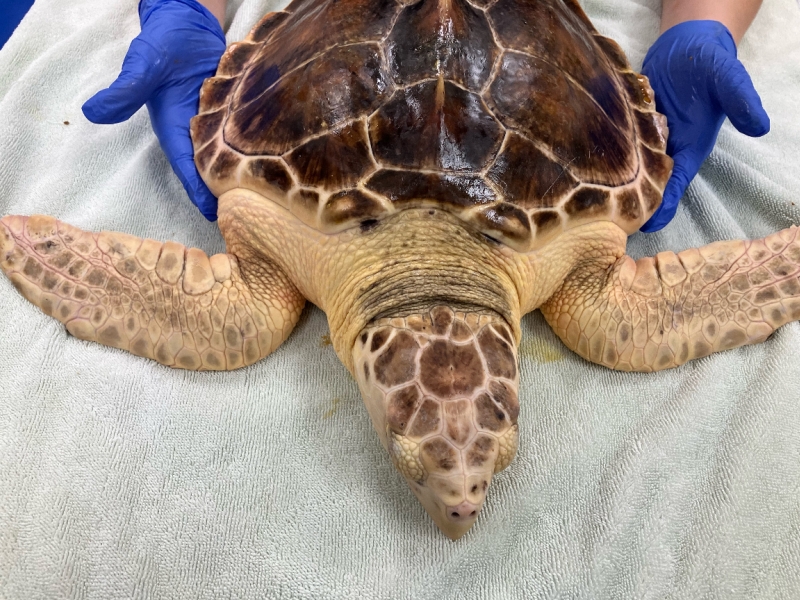
Kemp’s ridley / Loggerhead Hybrid Turtle Tagged at Jekyll Island
June 15, 2026
Researchers were surprised by an unusual turtle that stranded in Georgia-- a Kemp’s ridley / Loggerhead Hybrid Turtle, and were able to tag the animal for release.
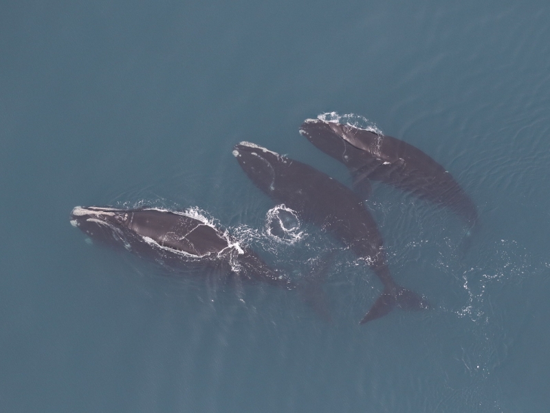
2024-2025 Large Whale Season Summary
March 24, 2025
We have two separate efforts focusing on cetaceans off the coast of Virginia. The first is our Offshore (Outer Continental Shelf) Cetacean Study, which focuses primarily on deep diving odontocetes like sperm whales. The second effort is our Nearshore and Mid-Shelf Baleen Whale Monitoring Project.
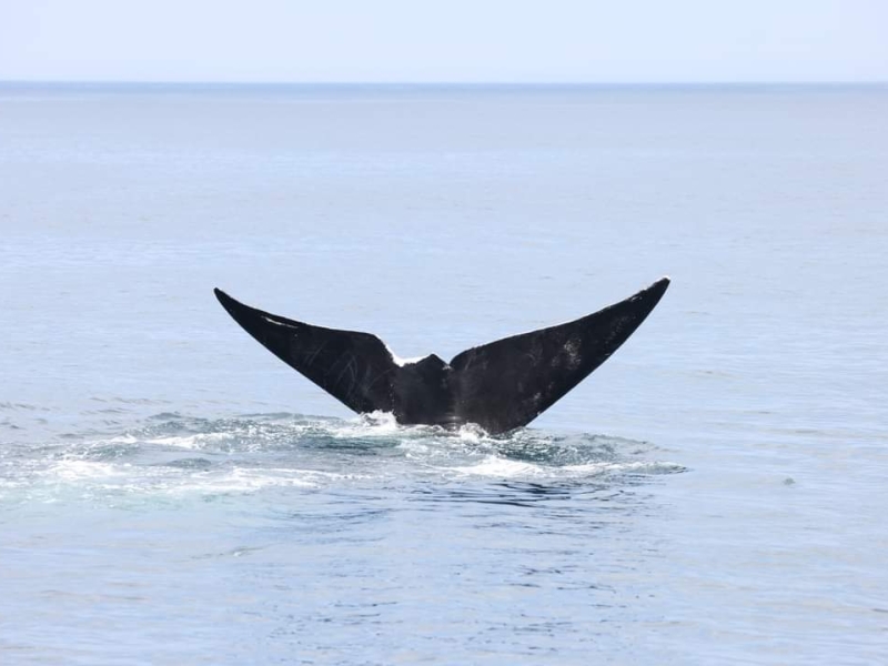
Whales of Summer
June 10, 2024
In the mid-Atlantic, baleen whale sightings typically occur during the colder months, with peak activity in December and January. Sightings of humpback and right whales usually decrease by late March through April. While occasional baleen whale sightings, particularly of fin whales, happen during warmer months, large groups are uncommon as summer approaches. Pelagic surveys during this time often focus on odontocetes like sperm whales and beaked whales.
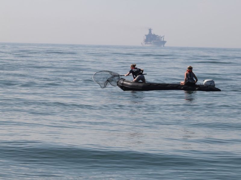
Turtle Tagging Season Has Begun!
May 18, 2015
Tagging loggerhead and Kemp's ridley sea turtles off Virginia.
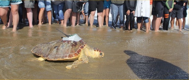
Sea Turtle Rehabilitation and Release
November 26, 2013
Tagging rescued sea turtles.
No related presentations or posters to display
